Langenlois geodata
Langenlois (Lower Austria) is a seat of a third-order administrative division; located in Austria in Europe/Vienna (GMT+2) time zone. With population of 4,777 people, there are 202 cities with bigger population in this country. Compared to other cities in Austria, 93.4% of cities are located further ↓South; 70.9% of cities are located further ←West and 79.5% of cities have higher elevation than Langenlois. Note1
Administrative division(s):
- Level 1: Lower Austria
- Level 2: Politischer Bezirk Krems
- Level 3: Langenlois


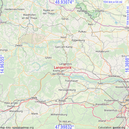
Langenlois GPS coordinates[2]
48° 28' 0.012" North, 15° 40' 0.012" East
| Map corner | latitude | longitude |
|---|---|---|
| Upper-left | 48.93074°, | 14.96355° |
| Center: | 48.46667°, | 15.66667° |
| Lower-right: | 47.99832°, | 16.3698° |
| Map W x H: | 103.7×103.7 km | = 64.4×64.4mi |
| max Lat: | 48.98333° ⇑6.6% North |
| Langenlois: | 48.46667° |
| min Lat: | ⇓93.4% South 46.48841° |
| min Long | Langenlois | max Long |
| 9.57802° | 15.66667° | 17.1° |
| W 70.9%⇐ | ⇒29.1% E |
Elevation
Elevation of Langenlois is 277 m = 909 ft, and this is 228.5 m = 750 ft below average elevation for this country.
| Max E: |
2140 m = 7021 ft | 79.5% |
| Avg. | 505.5 m = 1658 ft | |
| Langenlois | 277 m = 909 ft | |
Min E: |
118 m = 387 ft | 20.5% |
See also: Austria elevation on elevation.city.
Geographical zone
Langenlois is located in North temperate zone (between Tropic of Cancer and the Arctic Circle). Distance of this North polar circle is 2012.2 km =1250.3 mi to North.| Distance of | km | miles | from Langenlois |
|---|---|---|---|
| North Pole | 4618.1 | 2869.6 | to North |
| Arctic Circle | 2012.2 | 1250.3 | to North |
| Tropic Cancer | 2783.1 | 1729.3 | to South |
| Equator | 5389 | 3348.6 | to South |


Nearby cities:
15 places around Langenlois: (largest is in red/bold)
• Brunn im Felde
4.8 km =3 mi,  150°
150°
• Engabrunn
6.4 km =4 mi,  106°
106°
• Etsdorf am Kamp
6.2 km =3.9 mi,  127°
127°
• Gedersdorf
4.1 km =2.5 mi,  156°
156°
• Gneixendorf
4.8 km =3 mi,  227°
227°
• Gobelsburg
2.6 km =1.6 mi, 105°
• Hadersdorf am Kamp
4.1 km =2.5 mi,  116°
116°
• Imbach
6.4 km =4 mi,  253°
253°
• Landersdorf
6.1 km =3.8 mi,  203°
203°
• Lengenfeld
5 km =3.1 mi,  276°
276°
• Rohrendorf bei Krems
5.3 km =3.3 mi,  187°
187°
• Schönberg
6.1 km =3.8 mi,  23°
23°
• Strass
4.9 km =3 mi,  90°
90°
• Stratzing
5.3 km =3.3 mi, 249°
• Zöbing
2.2 km =1.4 mi,  33°
33°
Sources, notices
• [Note1] Compared only with cities in Austria existing in our database
• [Src1] Map data: © OpenStreetMap contributors (CC-BY-SA)
• [Src2] Other city data from geonames.org with taken over terms of usage.
• [Src3] Geographical zone / Annual Mean Temperature by Robert A. Rohde @ Wikipedia
