Lengenfeld geodata
Lengenfeld (Lower Austria) is a seat of a third-order administrative division; located in Austria in Europe/Vienna (GMT+2) time zone. With population of 1,412 people, there are 892 cities with bigger population in this country. Compared to other cities in Austria, 93.6% of cities are located further ↓South; 68.6% of cities are located further ←West and 74.6% of cities have higher elevation than Lengenfeld. Note1
Administrative division(s):
- Level 1: Lower Austria
- Level 2: Politischer Bezirk Krems
- Level 3: Lengenfeld


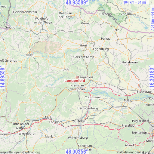
Lengenfeld GPS coordinates[2]
48° 28' 18.732" North, 15° 35' 55.32" East
| Map corner | latitude | longitude |
|---|---|---|
| Upper-left | 48.93589°, | 14.89558° |
| Center: | 48.47187°, | 15.5987° |
| Lower-right: | 48.00356°, | 16.30183° |
| Map W x H: | 103.7×103.7 km | = 64.4×64.4mi |
| max Lat: | 48.98333° ⇑6.4% North |
| Lengenfeld: | 48.47187° |
| min Lat: | ⇓93.6% South 46.48841° |
| min Long | Lengenfeld | max Long |
| 9.57802° | 15.5987° | 17.1° |
| W 68.6%⇐ | ⇒31.4% E |
Elevation
Elevation of Lengenfeld is 305 m = 1001 ft, and this is 200.5 m = 658 ft below average elevation for this country.
| Max E: |
2140 m = 7021 ft | 74.6% |
| Avg. | 505.5 m = 1658 ft | |
| Lengenfeld | 305 m = 1001 ft | |
Min E: |
118 m = 387 ft | 25.4% |
See also: Austria elevation on elevation.city.
Geographical zone
Lengenfeld is located in North temperate zone (between Tropic of Cancer and the Arctic Circle). Distance of this North polar circle is 2011.6 km =1249.9 mi to North.| Distance of | km | miles | from Lengenfeld |
|---|---|---|---|
| North Pole | 4617.5 | 2869.2 | to North |
| Arctic Circle | 2011.6 | 1249.9 | to North |
| Tropic Cancer | 2783.6 | 1729.6 | to South |
| Equator | 5389.6 | 3348.9 | to South |


Nearby cities:
15 places around Lengenfeld: (largest is in red/bold)
• Droß
1.9 km =1.2 mi,  242°
242°
• Egelsee
6.6 km =4.1 mi,  203°
203°
• Gneixendorf
4.1 km =2.5 mi,  159°
159°
• Gobelsburg
7.6 km =4.7 mi,  99°
99°
• Imbach
2.7 km =1.7 mi, 204°
• Krems an der Donau
7.1 km =4.4 mi,  170°
170°
• Landersdorf
6.6 km =4.1 mi, 157°
• Langenlois
5 km =3.1 mi, 96°
• Lerchenfeld
7.1 km =4.4 mi, 159°
• Rehberg
4.6 km =2.9 mi,  190°
190°
• Rohrendorf bei Krems
7.3 km =4.5 mi,  143°
143°
• Schiltern
5.2 km =3.2 mi,  14°
14°
• Senftenberg
5.6 km =3.5 mi,  219°
219°
• Stratzing
2.4 km =1.5 mi,  177°
177°
• Zöbing
6.4 km =4 mi,  78°
78°
Sources, notices
• [Note1] Compared only with cities in Austria existing in our database
• [Src1] Map data: © OpenStreetMap contributors (CC-BY-SA)
• [Src2] Other city data from geonames.org with taken over terms of usage.
• [Src3] Geographical zone / Annual Mean Temperature by Robert A. Rohde @ Wikipedia
