Hüttenberg geodata
Hüttenberg (Carinthia) is a seat of a third-order administrative division; located in Austria in Europe/Vienna (GMT+2) time zone. With population of 338 people, there are 2698 cities with bigger population in this country. Compared to other cities in Austria, 86.7% of cities are located further ↑North; 52.4% of cities are located further →East and 89.9% of cities have lower elevation than Hüttenberg. Note1
Administrative division(s):
- Level 1: Carinthia
- Level 2: Politischer Bezirk Sankt Veit an der Glan
- Level 3: Hüttenberg


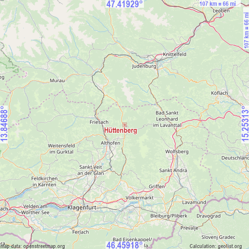
Hüttenberg GPS coordinates[2]
46° 56' 29.004" North, 14° 33' 0" East
| Map corner | latitude | longitude |
|---|---|---|
| Upper-left | 47.41929°, | 13.84688° |
| Center: | 46.94139°, | 14.55° |
| Lower-right: | 46.45918°, | 15.25313° |
| Map W x H: | 106.8×106.8 km | = 66.4×66.4mi |
| max Lat: | 48.98333° ⇑86.7% North |
| Hüttenberg: | 46.94139° |
| min Lat: | ⇓13.3% South 46.48841° |
| min Long | Hüttenberg | max Long |
| 9.57802° | 14.55° | 17.1° |
| W 47.6%⇐ | ⇒52.4% E |
Elevation
Elevation of Hüttenberg is 880 m = 2887 ft, and this is 374.5 m = 1229 ft above average elevation for this country.
| Max E: |
2140 m = 7021 ft | 10.1% |
| Hüttenberg | 880 m 2887 ft | |
| Avg. | 505.5 m = 1658 ft | |
Min E: |
118 m = 387 ft | 89.9% |
See also: Austria elevation on elevation.city.
Geographical zone
Hüttenberg is located in North temperate zone (between Tropic of Cancer and the Arctic Circle). Distance of this North polar circle is 2181.8 km =1355.7 mi to North.| Distance of | km | miles | from Hüttenberg |
|---|---|---|---|
| North Pole | 4787.7 | 2974.9 | to North |
| Arctic Circle | 2181.8 | 1355.7 | to North |
| Tropic Cancer | 2613.5 | 1624 | to South |
| Equator | 5219.4 | 3243.2 | to South |


Nearby cities:
15 places around Hüttenberg: (largest is in red/bold)
• Althofen
9.5 km =5.9 mi,  217°
217°
• Dürnstein in der Steiermark
13.1 km =8.1 mi,  293°
293°
• Eberstein
14.8 km =9.2 mi,  177°
177°
• Friesach
11.1 km =6.9 mi,  278°
278°
• Guttaring
6.9 km =4.3 mi,  205°
205°
• Kappel am Krappfeld
12.4 km =7.7 mi,  202°
202°
• Klein Sankt Paul
11.7 km =7.3 mi, 183°
• Kulm am Zirbitz
13.8 km =8.6 mi,  339°
339°
• Micheldorf
10.5 km =6.5 mi,  254°
254°
• Micheldorf in Kärnten
9.8 km =6.1 mi, 252°
• Mölbling
13.5 km =8.4 mi, 221°
• Mühlen
10.4 km =6.5 mi, 342°
• Sankt Georgen bei Neumarkt
16.1 km =10 mi,  329°
329°
• Sankt Salvator
15 km =9.3 mi, 282°
• Treibach
10.4 km =6.5 mi, 217°
Sources, notices
• [Note1] Compared only with cities in Austria existing in our database
• [Src1] Map data: © OpenStreetMap contributors (CC-BY-SA)
• [Src2] Other city data from geonames.org with taken over terms of usage.
• [Src3] Geographical zone / Annual Mean Temperature by Robert A. Rohde @ Wikipedia
