Gundersdorf geodata
Gundersdorf (Styria) is a seat of a third-order administrative division; located in Austria in Europe/Vienna (GMT+2) time zone. With population of 296 people, there are 2751 cities with bigger population in this country. Compared to other cities in Austria, 86.4% of cities are located further ↑North; 58.4% of cities are located further ←West and 58% of cities have lower elevation than Gundersdorf. Note1
Administrative division(s):
- Level 1: Styria
- Level 2: Politischer Bezirk Deutschlandsberg
- Level 3: Sankt Stefan ob Stainz


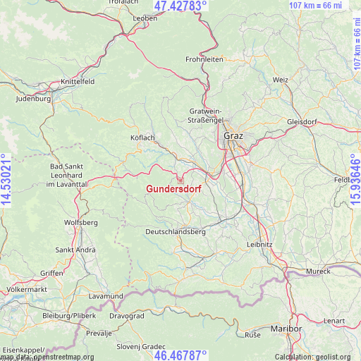
Gundersdorf GPS coordinates[2]
46° 57' 0" North, 15° 13' 59.988" East
| Map corner | latitude | longitude |
|---|---|---|
| Upper-left | 47.42783°, | 14.53021° |
| Center: | 46.95°, | 15.23333° |
| Lower-right: | 46.46787°, | 15.93646° |
| Map W x H: | 106.7×106.7 km | = 66.3×66.3mi |
| max Lat: | 48.98333° ⇑86.4% North |
| Gundersdorf: | 46.95° |
| min Lat: | ⇓13.6% South 46.48841° |
| min Long | Gundersdorf | max Long |
| 9.57802° | 15.23333° | 17.1° |
| W 58.4%⇐ | ⇒41.6% E |
Elevation
Elevation of Gundersdorf is 506 m = 1660 ft, and this is 0.5 m = 2 ft above average elevation for this country.
| Max E: |
2140 m = 7021 ft | 42% |
| Gundersdorf | 506 m 1660 ft | |
| Avg. | 505.5 m = 1658 ft | |
Min E: |
118 m = 387 ft | 58% |
See also: Austria elevation on elevation.city.
Geographical zone
Gundersdorf is located in North temperate zone (between Tropic of Cancer and the Arctic Circle). Distance of this North polar circle is 2180.8 km =1355.1 mi to North.| Distance of | km | miles | from Gundersdorf |
|---|---|---|---|
| North Pole | 4786.7 | 2974.3 | to North |
| Arctic Circle | 2180.8 | 1355.1 | to North |
| Tropic Cancer | 2614.4 | 1624.5 | to South |
| Equator | 5220.4 | 3243.8 | to South |


Nearby cities:
15 places around Gundersdorf: (largest is in red/bold)
• Blumegg
7.1 km =4.4 mi,  106°
106°
• Dietenberg
5.3 km =3.3 mi,  349°
349°
• Greisdorf
2.8 km =1.7 mi,  202°
202°
• Grosssöding
7.5 km =4.7 mi,  42°
42°
• Kleinsöding
6.7 km =4.2 mi,  34°
34°
• Krottendorf bei Ligist
7.5 km =4.7 mi, 350°
• Ligist
5.2 km =3.2 mi,  340°
340°
• Mooskirchen
4.9 km =3 mi, 44°
• Pichling bei Mooskirchen
7.8 km =4.8 mi,  18°
18°
• Pichling bei Stainz
6 km =3.7 mi,  145°
145°
• Sankt Stefan ob Stainz
3.1 km =1.9 mi,  140°
140°
• Schadendorf
7.5 km =4.7 mi,  59°
59°
• Stainz
6.7 km =4.2 mi,  157°
157°
• Steinberg bei Ligist
3.9 km =2.4 mi, 341°
• Zirknitz
2.1 km =1.3 mi,  92°
92°
Sources, notices
• [Note1] Compared only with cities in Austria existing in our database
• [Src1] Map data: © OpenStreetMap contributors (CC-BY-SA)
• [Src2] Other city data from geonames.org with taken over terms of usage.
• [Src3] Geographical zone / Annual Mean Temperature by Robert A. Rohde @ Wikipedia
