Blumegg geodata
Blumegg (Styria) is a populated place; located in Austria in Europe/Vienna (GMT+2) time zone. With population of 659 people, there are 1961 cities with bigger population in this country. Compared to other cities in Austria, 87.2% of cities are located further ↑North; 60.9% of cities are located further ←West and 57.1% of cities have higher elevation than Blumegg. Note1
Administrative division(s):
- Level 1: Styria
- Level 2: Politischer Bezirk Deutschlandsberg
- Level 3: Lannach


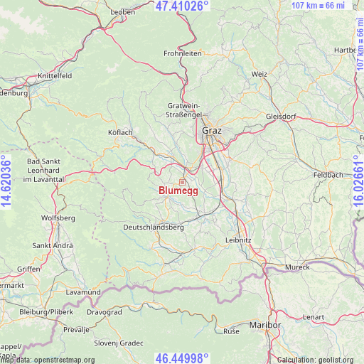
Blumegg GPS coordinates[2]
46° 55' 56.172" North, 15° 19' 24.528" East
| Map corner | latitude | longitude |
|---|---|---|
| Upper-left | 47.41026°, | 14.62036° |
| Center: | 46.93227°, | 15.32348° |
| Lower-right: | 46.44998°, | 16.02661° |
| Map W x H: | 106.8×106.8 km | = 66.4×66.4mi |
| max Lat: | 48.98333° ⇑87.2% North |
| Blumegg: | 46.93227° |
| min Lat: | ⇓12.8% South 46.48841° |
| min Long | Blumegg | max Long |
| 9.57802° | 15.32348° | 17.1° |
| W 60.9%⇐ | ⇒39.1% E |
Elevation
Elevation of Blumegg is 405 m = 1329 ft, and this is 100.5 m = 330 ft below average elevation for this country.
| Max E: |
2140 m = 7021 ft | 57.1% |
| Avg. | 505.5 m = 1658 ft | |
| Blumegg | 405 m = 1329 ft | |
Min E: |
118 m = 387 ft | 42.9% |
See also: Austria elevation on elevation.city.
Geographical zone
Blumegg is located in North temperate zone (between Tropic of Cancer and the Arctic Circle). Distance of this North polar circle is 2182.8 km =1356.3 mi to North.| Distance of | km | miles | from Blumegg |
|---|---|---|---|
| North Pole | 4788.7 | 2975.6 | to North |
| Arctic Circle | 2182.8 | 1356.3 | to North |
| Tropic Cancer | 2612.5 | 1623.3 | to South |
| Equator | 5218.4 | 3242.6 | to South |


Nearby cities:
15 places around Blumegg: (largest is in red/bold)
• Dobldorf
3.8 km =2.4 mi,  58°
58°
• Graschuh
6.7 km =4.2 mi,  213°
213°
• Lannach
1.9 km =1.2 mi,  34°
34°
• Lieboch
4.8 km =3 mi,  12°
12°
• Mooskirchen
6.5 km =4 mi,  328°
328°
• Muttendorf
3.3 km =2.1 mi,  87°
87°
• Pichling bei Stainz
4.5 km =2.8 mi,  228°
228°
• Sankt Josef (Weststeiermark)
2.7 km =1.7 mi,  159°
159°
• Sankt Stefan ob Stainz
4.9 km =3 mi,  265°
265°
• Schadendorf
5.8 km =3.6 mi,  356°
356°
• Spatenhof
4.4 km =2.7 mi,  40°
40°
• Stainz
6 km =3.7 mi, 225°
• Stallhof
6.2 km =3.9 mi, 209°
• Unterpremstätten
7.1 km =4.4 mi, 59°
• Zirknitz
5.1 km =3.2 mi,  291°
291°
Sources, notices
• [Note1] Compared only with cities in Austria existing in our database
• [Src1] Map data: © OpenStreetMap contributors (CC-BY-SA)
• [Src2] Other city data from geonames.org with taken over terms of usage.
• [Src3] Geographical zone / Annual Mean Temperature by Robert A. Rohde @ Wikipedia
