Gottsdorf geodata
Gottsdorf (Lower Austria) is a populated place; located in Austria in Europe/Vienna (GMT+2) time zone. With population of 707 people, there are 1839 cities with bigger population in this country. Compared to other cities in Austria, 78.6% of cities are located further ↓South; 56% of cities are located further ←West and 88.8% of cities have higher elevation than Gottsdorf. Note1
Administrative division(s):
- Level 1: Lower Austria
- Level 2: Politischer Bezirk Melk
- Level 3: Persenbeug-Gottsdorf


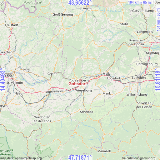
Gottsdorf GPS coordinates[2]
48° 11' 22.596" North, 15° 6' 28.98" East
| Map corner | latitude | longitude |
|---|---|---|
| Upper-left | 48.65622°, | 14.40493° |
| Center: | 48.18961°, | 15.10805° |
| Lower-right: | 47.71871°, | 15.81118° |
| Map W x H: | 104.2×104.2 km | = 64.7×64.7mi |
| max Lat: | 48.98333° ⇑21.4% North |
| Gottsdorf: | 48.18961° |
| min Lat: | ⇓78.6% South 46.48841° |
| min Long | Gottsdorf | max Long |
| 9.57802° | 15.10805° | 17.1° |
| W 56%⇐ | ⇒44% E |
Elevation
Elevation of Gottsdorf is 223 m = 732 ft, and this is 282.5 m = 927 ft below average elevation for this country.
| Max E: |
2140 m = 7021 ft | 88.8% |
| Avg. | 505.5 m = 1658 ft | |
| Gottsdorf | 223 m = 732 ft | |
Min E: |
118 m = 387 ft | 11.2% |
See also: Austria elevation on elevation.city.
Geographical zone
Gottsdorf is located in North temperate zone (between Tropic of Cancer and the Arctic Circle). Distance of this North polar circle is 2043 km =1269.5 mi to North.| Distance of | km | miles | from Gottsdorf |
|---|---|---|---|
| North Pole | 4648.9 | 2888.7 | to North |
| Arctic Circle | 2043 | 1269.5 | to North |
| Tropic Cancer | 2752.3 | 1710.2 | to South |
| Equator | 5358.2 | 3329.4 | to South |


Nearby cities:
15 places around Gottsdorf: (largest is in red/bold)
• Erlauf
5.6 km =3.5 mi,  97°
97°
• Golling
5.7 km =3.5 mi,  78°
78°
• Göttsbach
4 km =2.5 mi,  230°
230°
• Hofamt Priel
2.4 km =1.5 mi,  286°
286°
• Krummnußbaum an der Donauuferbahn
5.2 km =3.2 mi,  55°
55°
• Krumnussbaum
4.5 km =2.8 mi, 62°
• Marbach an der Donau
4.3 km =2.7 mi,  45°
45°
• Maria Taferl
5.6 km =3.5 mi,  42°
42°
• Neuda
5.7 km =3.5 mi,  73°
73°
• Neumarkt an der Ybbs
6.6 km =4.1 mi,  214°
214°
• Persenbeug
1.5 km =0.9 mi,  260°
260°
• Petzenkirchen
5.9 km =3.7 mi,  143°
143°
• Pöchlarn
6.9 km =4.3 mi, 80°
• Wieselburg
6.5 km =4 mi,  163°
163°
• Ybbs an der Donau
3.1 km =1.9 mi,  215°
215°
Sources, notices
• [Note1] Compared only with cities in Austria existing in our database
• [Src1] Map data: © OpenStreetMap contributors (CC-BY-SA)
• [Src2] Other city data from geonames.org with taken over terms of usage.
• [Src3] Geographical zone / Annual Mean Temperature by Robert A. Rohde @ Wikipedia
