Wieselburg geodata
Wieselburg (Lower Austria) is a seat of a third-order administrative division; located in Austria in Europe/Vienna (GMT+2) time zone. With population of 4,143 people, there are 246 cities with bigger population in this country. Compared to other cities in Austria, 74.5% of cities are located further ↓South; 56.5% of cities are located further ←West and 83% of cities have higher elevation than Wieselburg. Note1
Administrative division(s):
- Level 1: Lower Austria
- Level 2: Politischer Bezirk Scheibbs
- Level 3: Wieselburg-Land


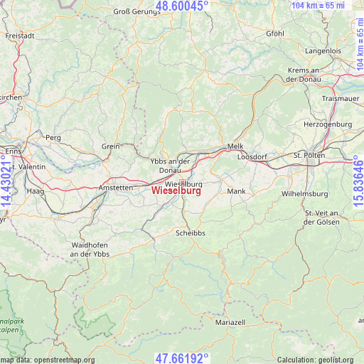
Wieselburg GPS coordinates[2]
48° 7' 59.988" North, 15° 7' 59.988" East
| Map corner | latitude | longitude |
|---|---|---|
| Upper-left | 48.60045°, | 14.43021° |
| Center: | 48.13333°, | 15.13333° |
| Lower-right: | 47.66192°, | 15.83646° |
| Map W x H: | 104.4×104.4 km | = 64.9×64.9mi |
| max Lat: | 48.98333° ⇑25.5% North |
| Wieselburg: | 48.13333° |
| min Lat: | ⇓74.5% South 46.48841° |
| min Long | Wieselburg | max Long |
| 9.57802° | 15.13333° | 17.1° |
| W 56.5%⇐ | ⇒43.5% E |
Elevation
Elevation of Wieselburg is 258 m = 846 ft, and this is 247.5 m = 812 ft below average elevation for this country.
| Max E: |
2140 m = 7021 ft | 83% |
| Avg. | 505.5 m = 1658 ft | |
| Wieselburg | 258 m = 846 ft | |
Min E: |
118 m = 387 ft | 17% |
See also: Austria elevation on elevation.city.
Geographical zone
Wieselburg is located in North temperate zone (between Tropic of Cancer and the Arctic Circle). Distance of this North polar circle is 2049.2 km =1273.3 mi to North.| Distance of | km | miles | from Wieselburg |
|---|---|---|---|
| North Pole | 4655.1 | 2892.5 | to North |
| Arctic Circle | 2049.2 | 1273.3 | to North |
| Tropic Cancer | 2746 | 1706.3 | to South |
| Equator | 5351.9 | 3325.5 | to South |


Nearby cities:
15 places around Wieselburg: (largest is in red/bold)
• Bergland
4.6 km =2.9 mi,  56°
56°
• Erlauf
6.7 km =4.2 mi,  33°
33°
• Golling
8.3 km =5.2 mi, 26°
• Gottsdorf
6.5 km =4 mi,  343°
343°
• Göttsbach
6.2 km =3.9 mi,  306°
306°
• Hofamt Priel
8.1 km =5 mi,  329°
329°
• Krumnussbaum
8.7 km =5.4 mi,  14°
14°
• Mühling
3.5 km =2.2 mi,  181°
181°
• Neumarkt an der Ybbs
5.7 km =3.5 mi,  278°
278°
• Persenbeug
6.9 km =4.3 mi, 330°
• Petzenkirchen
2.2 km =1.4 mi,  46°
46°
• Purgstall
8.3 km =5.2 mi, 179°
• Weinzierl
0.8 km =0.5 mi,  219°
219°
• Wolfpassing
8 km =5 mi, 219°
• Ybbs an der Donau
5.2 km =3.2 mi, 314°
Sources, notices
• [Note1] Compared only with cities in Austria existing in our database
• [Src1] Map data: © OpenStreetMap contributors (CC-BY-SA)
• [Src2] Other city data from geonames.org with taken over terms of usage.
• [Src3] Geographical zone / Annual Mean Temperature by Robert A. Rohde @ Wikipedia
