Aufhausen geodata
Aufhausen (Salzburg) is a populated place; located in Austria in Europe/Vienna (GMT+2) time zone. With population of 580 people, there are 2212 cities with bigger population in this country. Compared to other cities in Austria, 65.7% of cities are located further ↑North; 84.9% of cities are located further →East and 87.7% of cities have lower elevation than Aufhausen. Note1
Administrative division(s):
- Level 1: Salzburg
- Level 2: Politischer Bezirk Zell am See
- Level 3: Piesendorf


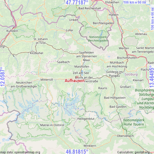
Aufhausen GPS coordinates[2]
47° 17' 49.776" North, 12° 45' 42.552" East
| Map corner | latitude | longitude |
|---|---|---|
| Upper-left | 47.77187°, | 12.0587° |
| Center: | 47.29716°, | 12.76182° |
| Lower-right: | 46.81815°, | 13.46495° |
| Map W x H: | 106×106 km | = 65.9×65.9mi |
| max Lat: | 48.98333° ⇑65.7% North |
| Aufhausen: | 47.29716° |
| min Lat: | ⇓34.3% South 46.48841° |
| min Long | Aufhausen | max Long |
| 9.57802° | 12.76182° | 17.1° |
| W 15.1%⇐ | ⇒84.9% E |
Elevation
Elevation of Aufhausen is 840 m = 2756 ft, and this is 334.5 m = 1097 ft above average elevation for this country.
| Max E: |
2140 m = 7021 ft | 12.3% |
| Aufhausen | 840 m 2756 ft | |
| Avg. | 505.5 m = 1658 ft | |
Min E: |
118 m = 387 ft | 87.7% |
See also: Austria elevation on elevation.city.
Geographical zone
Aufhausen is located in North temperate zone (between Tropic of Cancer and the Arctic Circle). Distance of this North polar circle is 2142.2 km =1331.1 mi to North.| Distance of | km | miles | from Aufhausen |
|---|---|---|---|
| North Pole | 4748.1 | 2950.3 | to North |
| Arctic Circle | 2142.2 | 1331.1 | to North |
| Tropic Cancer | 2653 | 1648.5 | to South |
| Equator | 5259 | 3267.8 | to South |


Nearby cities:
15 places around Aufhausen: (largest is in red/bold)
• Atzing
7.3 km =4.5 mi,  23°
23°
• Bruck an der Großglocknerstraße
4.8 km =3 mi,  106°
106°
• Kaprun
2.8 km =1.7 mi,  183°
183°
• Krössenbach
4.4 km =2.7 mi, 110°
• Maishofen
8.2 km =5.1 mi, 20°
• Mitterhofen
10 km =6.2 mi, 16°
• Niedernsill
8.6 km =5.3 mi,  259°
259°
• Pichl
6.8 km =4.2 mi,  103°
103°
• Piesendorf
3.4 km =2.1 mi, 257°
• Schmitten
3.5 km =2.2 mi, 19°
• Steindorf
8.9 km =5.5 mi, 262°
• Thumersbach
5.5 km =3.4 mi,  49°
49°
• Viehhofen
8 km =5 mi,  344°
344°
• Walchen
5.7 km =3.5 mi, 259°
• Zell am See
4 km =2.5 mi,  37°
37°
Sources, notices
• [Note1] Compared only with cities in Austria existing in our database
• [Src1] Map data: © OpenStreetMap contributors (CC-BY-SA)
• [Src2] Other city data from geonames.org with taken over terms of usage.
• [Src3] Geographical zone / Annual Mean Temperature by Robert A. Rohde @ Wikipedia
