Thumersbach geodata
Thumersbach (Salzburg) is a populated place; located in Austria in Europe/Vienna (GMT+2) time zone. With population of 1,010 people, there are 1274 cities with bigger population in this country. Compared to other cities in Austria, 63.6% of cities are located further ↑North; 84.5% of cities are located further →East and 83.1% of cities have lower elevation than Thumersbach. Note1
Administrative division(s):
- Level 1: Salzburg
- Level 2: Politischer Bezirk Zell am See
- Level 3: Zell am See


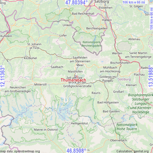
Thumersbach GPS coordinates[2]
47° 19' 46.272" North, 12° 49' 0.3" East
| Map corner | latitude | longitude |
|---|---|---|
| Upper-left | 47.80394°, | 12.11363° |
| Center: | 47.32952°, | 12.81675° |
| Lower-right: | 46.8508°, | 13.51988° |
| Map W x H: | 106×106 km | = 65.9×65.9mi |
| max Lat: | 48.98333° ⇑63.6% North |
| Thumersbach: | 47.32952° |
| min Lat: | ⇓36.4% South 46.48841° |
| min Long | Thumersbach | max Long |
| 9.57802° | 12.81675° | 17.1° |
| W 15.5%⇐ | ⇒84.5% E |
Elevation
Elevation of Thumersbach is 769 m = 2523 ft, and this is 263.5 m = 865 ft above average elevation for this country.
| Max E: |
2140 m = 7021 ft | 16.9% |
| Thumersbach | 769 m 2523 ft | |
| Avg. | 505.5 m = 1658 ft | |
Min E: |
118 m = 387 ft | 83.1% |
See also: Austria elevation on elevation.city.
Geographical zone
Thumersbach is located in North temperate zone (between Tropic of Cancer and the Arctic Circle). Distance of this North polar circle is 2138.6 km =1328.9 mi to North.| Distance of | km | miles | from Thumersbach |
|---|---|---|---|
| North Pole | 4744.5 | 2948.1 | to North |
| Arctic Circle | 2138.6 | 1328.9 | to North |
| Tropic Cancer | 2656.6 | 1650.7 | to South |
| Equator | 5262.5 | 3270 | to South |


Nearby cities:
15 places around Thumersbach: (largest is in red/bold)
• Atzing
3.4 km =2.1 mi,  337°
337°
• Aufhausen
5.5 km =3.4 mi,  229°
229°
• Bruck an der Großglocknerstraße
5 km =3.1 mi,  174°
174°
• Bsuch
8.2 km =5.1 mi,  11°
11°
• Haid
8.8 km =5.5 mi,  1°
1°
• Kaprun
7.7 km =4.8 mi,  214°
214°
• Krössenbach
5.1 km =3.2 mi,  180°
180°
• Maishofen
4.3 km =2.7 mi, 343°
• Mitterhofen
6.1 km =3.8 mi,  348°
348°
• Pichl
5.7 km =3.5 mi,  153°
153°
• Piesendorf
8.6 km =5.3 mi,  239°
239°
• Schmitten
3 km =1.9 mi,  264°
264°
• Thor
10.4 km =6.5 mi, 11°
• Viehhofen
7.5 km =4.7 mi,  303°
303°
• Zell am See
1.7 km =1.1 mi, 255°
Sources, notices
• [Note1] Compared only with cities in Austria existing in our database
• [Src1] Map data: © OpenStreetMap contributors (CC-BY-SA)
• [Src2] Other city data from geonames.org with taken over terms of usage.
• [Src3] Geographical zone / Annual Mean Temperature by Robert A. Rohde @ Wikipedia
