Mitterhofen geodata
Mitterhofen (Salzburg) is a populated place; located in Austria in Europe/Vienna (GMT+2) time zone. With population of 1,118 people, there are 1139 cities with bigger population in this country. Compared to other cities in Austria, 60.9% of cities are located further ↑North; 84.7% of cities are located further →East and 83.6% of cities have lower elevation than Mitterhofen. Note1
Administrative division(s):
- Level 1: Salzburg
- Level 2: Politischer Bezirk Zell am See
- Level 3: Maishofen


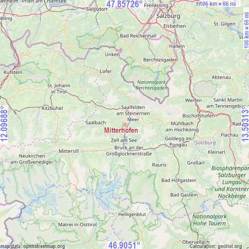
Mitterhofen GPS coordinates[2]
47° 22' 59.988" North, 12° 48' 0" East
| Map corner | latitude | longitude |
|---|---|---|
| Upper-left | 47.85726°, | 12.09688° |
| Center: | 47.38333°, | 12.8° |
| Lower-right: | 46.9051°, | 13.50313° |
| Map W x H: | 105.9×105.9 km | = 65.8×65.8mi |
| max Lat: | 48.98333° ⇑60.9% North |
| Mitterhofen: | 47.38333° |
| min Lat: | ⇓39.1% South 46.48841° |
| min Long | Mitterhofen | max Long |
| 9.57802° | 12.8° | 17.1° |
| W 15.3%⇐ | ⇒84.7% E |
Elevation
Elevation of Mitterhofen is 777 m = 2549 ft, and this is 271.5 m = 891 ft above average elevation for this country.
| Max E: |
2140 m = 7021 ft | 16.4% |
| Mitterhofen | 777 m 2549 ft | |
| Avg. | 505.5 m = 1658 ft | |
Min E: |
118 m = 387 ft | 83.6% |
See also: Austria elevation on elevation.city.
Geographical zone
Mitterhofen is located in North temperate zone (between Tropic of Cancer and the Arctic Circle). Distance of this North polar circle is 2132.6 km =1325.1 mi to North.| Distance of | km | miles | from Mitterhofen |
|---|---|---|---|
| North Pole | 4738.5 | 2944.4 | to North |
| Arctic Circle | 2132.6 | 1325.1 | to North |
| Tropic Cancer | 2662.6 | 1654.5 | to South |
| Equator | 5268.5 | 3273.7 | to South |


Nearby cities:
15 places around Mitterhofen: (largest is in red/bold)
• Atzing
2.9 km =1.8 mi,  180°
180°
• Bsuch
3.5 km =2.2 mi,  55°
55°
• Dorfheim
6.2 km =3.9 mi,  26°
26°
• Haid
3.2 km =2 mi, 27°
• Lenzing
7.2 km =4.5 mi,  9°
9°
• Leogang
6.9 km =4.3 mi,  334°
334°
• Maishofen
1.9 km =1.2 mi, 180°
• Maria Alm am Steinernen Meer
8 km =5 mi,  71°
71°
• Ramseiden
6.9 km =4.3 mi,  49°
49°
• Saalfelden am Steinernen Meer
6 km =3.7 mi,  36°
36°
• Schmitten
6.5 km =4 mi,  195°
195°
• Thor
5.4 km =3.4 mi, 37°
• Thumersbach
6.1 km =3.8 mi,  168°
168°
• Viehhofen
5.4 km =3.4 mi,  249°
249°
• Zell am See
6.4 km =4 mi, 183°
Sources, notices
• [Note1] Compared only with cities in Austria existing in our database
• [Src1] Map data: © OpenStreetMap contributors (CC-BY-SA)
• [Src2] Other city data from geonames.org with taken over terms of usage.
• [Src3] Geographical zone / Annual Mean Temperature by Robert A. Rohde @ Wikipedia
