Andorf geodata
Andorf (Upper Austria) is a seat of a third-order administrative division; located in Austria in Europe/Vienna (GMT+2) time zone. With population of 2,851 people, there are 402 cities with bigger population in this country. Compared to other cities in Austria, 89.5% of cities are located further ↓South; 73.8% of cities are located further →East and 67.3% of cities have higher elevation than Andorf. Note1
Administrative division(s):
- Level 1: Upper Austria
- Level 2: Politischer Bezirk Schärding
- Level 3: Andorf


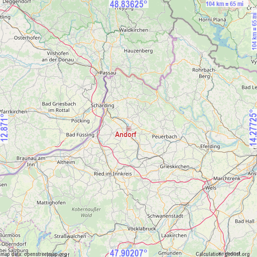
Andorf GPS coordinates[2]
48° 22' 16.68" North, 13° 34' 26.832" East
| Map corner | latitude | longitude |
|---|---|---|
| Upper-left | 48.83625°, | 12.871° |
| Center: | 48.3713°, | 13.57412° |
| Lower-right: | 47.90207°, | 14.27725° |
| Map W x H: | 103.9×103.9 km | = 64.6×64.6mi |
| max Lat: | 48.98333° ⇑10.5% North |
| Andorf: | 48.3713° |
| min Lat: | ⇓89.5% South 46.48841° |
| min Long | Andorf | max Long |
| 9.57802° | 13.57412° | 17.1° |
| W 26.2%⇐ | ⇒73.8% E |
Elevation
Elevation of Andorf is 341 m = 1119 ft, and this is 164.5 m = 540 ft below average elevation for this country.
| Max E: |
2140 m = 7021 ft | 67.3% |
| Avg. | 505.5 m = 1658 ft | |
| Andorf | 341 m = 1119 ft | |
Min E: |
118 m = 387 ft | 32.7% |
See also: Austria elevation on elevation.city.
Geographical zone
Andorf is located in North temperate zone (between Tropic of Cancer and the Arctic Circle). Distance of this North polar circle is 2022.8 km =1256.9 mi to North.| Distance of | km | miles | from Andorf |
|---|---|---|---|
| North Pole | 4628.7 | 2876.1 | to North |
| Arctic Circle | 2022.8 | 1256.9 | to North |
| Tropic Cancer | 2772.5 | 1722.8 | to South |
| Equator | 5378.4 | 3342 | to South |


Nearby cities:
15 places around Andorf: (largest is in red/bold)
• Antiesenhofen
13.2 km =8.2 mi,  257°
257°
• Bubing
12.5 km =7.8 mi,  317°
317°
• Enzenkirchen
5.8 km =3.6 mi,  71°
71°
• Kopfing im Innkreis
9.8 km =6.1 mi,  39°
39°
• Münzkirchen
12.5 km =7.8 mi,  357°
357°
• Ort im Innkreis
12 km =7.5 mi,  239°
239°
• Raab
5.8 km =3.6 mi,  111°
111°
• Sankt Marienkirchen bei Schärding
9.3 km =5.8 mi,  280°
280°
• Sankt Martin im Innkreis
13.2 km =8.2 mi,  229°
229°
• Sankt Roman
12.6 km =7.8 mi,  12°
12°
• Sigharting
3.3 km =2.1 mi,  32°
32°
• Suben
11.5 km =7.1 mi,  293°
293°
• Taiskirchen im Innkreis
11.9 km =7.4 mi,  180°
180°
• Taufkirchen an der Pram
5.1 km =3.2 mi,  329°
329°
• Zell an der Pram
7.4 km =4.6 mi,  146°
146°
Sources, notices
• [Note1] Compared only with cities in Austria existing in our database
• [Src1] Map data: © OpenStreetMap contributors (CC-BY-SA)
• [Src2] Other city data from geonames.org with taken over terms of usage.
• [Src3] Geographical zone / Annual Mean Temperature by Robert A. Rohde @ Wikipedia
