Bubing geodata
Bubing (Upper Austria) is a populated place; located in Austria in Europe/Vienna (GMT+2) time zone. With population of 548 people, there are 2329 cities with bigger population in this country. Compared to other cities in Austria, 92.9% of cities are located further ↓South; 75.6% of cities are located further →East and 66.4% of cities have higher elevation than Bubing. Note1
Administrative division(s):
- Level 1: Upper Austria
- Level 2: Politischer Bezirk Schärding
- Level 3: Sankt Florian am Inn


Bubing GPS coordinates[2]
48° 27' 16.56" North, 13° 27' 35.568" East
| Map corner | latitude | longitude |
|---|---|---|
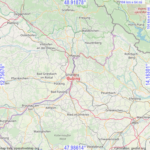
| Upper-left | 48.91878°, | 12.75676° |
| Center: | 48.4546°, | 13.45988° |
| Lower-right: | 47.98614°, | 14.16301° |
| Map W x H: | 103.7×103.7 km | = 64.4×64.4mi |
| max Lat: | 48.98333° ⇑7.1% North |
| Bubing: | 48.4546° |
| min Lat: | ⇓92.9% South 46.48841° |
| min Long | Bubing | max Long |
| 9.57802° | 13.45988° | 17.1° |
| W 24.4%⇐ | ⇒75.6% E |
Elevation
Elevation of Bubing is 345 m = 1132 ft, and this is 160.5 m = 527 ft below average elevation for this country.
| Max E: |
2140 m = 7021 ft | 66.4% |
| Avg. | 505.5 m = 1658 ft | |
| Bubing | 345 m = 1132 ft | |
Min E: |
118 m = 387 ft | 33.6% |
See also: Austria elevation on elevation.city.
Geographical zone
Bubing is located in North temperate zone (between Tropic of Cancer and the Arctic Circle). Distance of this North polar circle is 2013.5 km =1251.1 mi to North.| Distance of | km | miles | from Bubing |
|---|---|---|---|
| North Pole | 4619.4 | 2870.4 | to North |
| Arctic Circle | 2013.5 | 1251.1 | to North |
| Tropic Cancer | 2781.7 | 1728.5 | to South |
| Equator | 5387.6 | 3347.7 | to South |


Nearby cities:
15 places around Bubing: (largest is in red/bold)
• Allerheiligen
1.9 km =1.2 mi,  312°
312°
• Andorf
12.5 km =7.8 mi,  137°
137°
• Antiesenhofen
13 km =8.1 mi,  200°
200°
• Esternberg
12.8 km =8 mi,  39°
39°
• Münzkirchen
8.5 km =5.3 mi,  67°
67°
• Sankt Marienkirchen bei Schärding
7.5 km =4.7 mi,  185°
185°
• Sankt Roman
11.5 km =7.1 mi, 74°
• Schardenberg
7.9 km =4.9 mi,  20°
20°
• Schärding
1.7 km =1.1 mi,  263°
263°
• Schärding Innere Stadt
2.2 km =1.4 mi,  276°
276°
• Schärding Vorstadt
1.5 km =0.9 mi, 258°
• Sigharting
12.1 km =7.5 mi,  122°
122°
• Suben
5.2 km =3.2 mi, 204°
• Taufkirchen an der Pram
7.6 km =4.7 mi,  129°
129°
• Wernstein am Inn
5.9 km =3.7 mi,  0°
0°
Sources, notices
• [Note1] Compared only with cities in Austria existing in our database
• [Src1] Map data: © OpenStreetMap contributors (CC-BY-SA)
• [Src2] Other city data from geonames.org with taken over terms of usage.
• [Src3] Geographical zone / Annual Mean Temperature by Robert A. Rohde @ Wikipedia
