Hitzing geodata
Hitzing (Upper Austria) is a populated place; located in Austria in Europe/Vienna (GMT+2) time zone. With population of 509 people, there are 2475 cities with bigger population in this country. Compared to other cities in Austria, 84.2% of cities are located further ↓South; 60.5% of cities are located further →East and 70.5% of cities have higher elevation than Hitzing. Note1
Administrative division(s):
- Level 1: Upper Austria
- Level 2: Politischer Bezirk Linz-Land
- Level 3: Wilhering


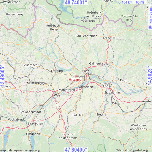
Hitzing GPS coordinates[2]
48° 16' 27.012" North, 14° 11' 57.012" East
| Map corner | latitude | longitude |
|---|---|---|
| Upper-left | 48.74001°, | 13.49605° |
| Center: | 48.27417°, | 14.19917° |
| Lower-right: | 47.80405°, | 14.9023° |
| Map W x H: | 104.1×104.1 km | = 64.7×64.7mi |
| max Lat: | 48.98333° ⇑15.8% North |
| Hitzing: | 48.27417° |
| min Lat: | ⇓84.2% South 46.48841° |
| min Long | Hitzing | max Long |
| 9.57802° | 14.19917° | 17.1° |
| W 39.5%⇐ | ⇒60.5% E |
Elevation
Elevation of Hitzing is 325 m = 1066 ft, and this is 180.5 m = 592 ft below average elevation for this country.
| Max E: |
2140 m = 7021 ft | 70.5% |
| Avg. | 505.5 m = 1658 ft | |
| Hitzing | 325 m = 1066 ft | |
Min E: |
118 m = 387 ft | 29.5% |
See also: Austria elevation on elevation.city.
Geographical zone
Hitzing is located in North temperate zone (between Tropic of Cancer and the Arctic Circle). Distance of this North polar circle is 2033.6 km =1263.6 mi to North.| Distance of | km | miles | from Hitzing |
|---|---|---|---|
| North Pole | 4639.5 | 2882.9 | to North |
| Arctic Circle | 2033.6 | 1263.6 | to North |
| Tropic Cancer | 2761.7 | 1716 | to South |
| Equator | 5367.6 | 3335.3 | to South |


Nearby cities:
15 places around Hitzing: (largest is in red/bold)
• Berg
4.1 km =2.5 mi,  60°
60°
• Bergham
2.5 km =1.6 mi,  70°
70°
• Dörnbach
1 km =0.6 mi,  21°
21°
• Edramsberg
4.7 km =2.9 mi,  335°
335°
• Hart
4.4 km =2.7 mi,  103°
103°
• Leonding
4.1 km =2.5 mi,  81°
81°
• Mühlbach
3.5 km =2.2 mi, 344°
• Pasching
1.7 km =1.1 mi,  168°
168°
• Reith
2.5 km =1.6 mi,  318°
318°
• Reith
3.4 km =2.1 mi,  105°
105°
• Rufling
1.4 km =0.9 mi, 70°
• Schönering
3.9 km =2.4 mi,  313°
313°
• Strassham
4.1 km =2.5 mi,  284°
284°
• Thening
3.1 km =1.9 mi,  227°
227°
• Wagram
4.6 km =2.9 mi,  150°
150°
Sources, notices
• [Note1] Compared only with cities in Austria existing in our database
• [Src1] Map data: © OpenStreetMap contributors (CC-BY-SA)
• [Src2] Other city data from geonames.org with taken over terms of usage.
• [Src3] Geographical zone / Annual Mean Temperature by Robert A. Rohde @ Wikipedia
