Thening geodata
Thening (Upper Austria) is a populated place; located in Austria in Europe/Vienna (GMT+2) time zone. With population of 836 people, there are 1544 cities with bigger population in this country. Compared to other cities in Austria, 83.1% of cities are located further ↓South; 61.4% of cities are located further →East and 72.4% of cities have higher elevation than Thening. Note1
Administrative division(s):
- Level 1: Upper Austria
- Level 2: Politischer Bezirk Linz-Land
- Level 3: Kirchberg-Thening


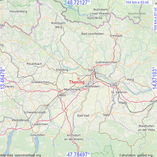
Thening GPS coordinates[2]
48° 15' 18.936" North, 14° 10' 4.44" East
| Map corner | latitude | longitude |
|---|---|---|
| Upper-left | 48.72127°, | 13.46478° |
| Center: | 48.25526°, | 14.1679° |
| Lower-right: | 47.78497°, | 14.87103° |
| Map W x H: | 104.1×104.1 km | = 64.7×64.7mi |
| max Lat: | 48.98333° ⇑16.9% North |
| Thening: | 48.25526° |
| min Lat: | ⇓83.1% South 46.48841° |
| min Long | Thening | max Long |
| 9.57802° | 14.1679° | 17.1° |
| W 38.6%⇐ | ⇒61.4% E |
Elevation
Elevation of Thening is 317 m = 1040 ft, and this is 188.5 m = 618 ft below average elevation for this country.
| Max E: |
2140 m = 7021 ft | 72.4% |
| Avg. | 505.5 m = 1658 ft | |
| Thening | 317 m = 1040 ft | |
Min E: |
118 m = 387 ft | 27.6% |
See also: Austria elevation on elevation.city.
Geographical zone
Thening is located in North temperate zone (between Tropic of Cancer and the Arctic Circle). Distance of this North polar circle is 2035.7 km =1264.9 mi to North.| Distance of | km | miles | from Thening |
|---|---|---|---|
| North Pole | 4641.6 | 2884.2 | to North |
| Arctic Circle | 2035.7 | 1264.9 | to North |
| Tropic Cancer | 2759.6 | 1714.7 | to South |
| Equator | 5365.5 | 3334 | to South |


Nearby cities:
15 places around Thening: (largest is in red/bold)
• Bergham
5.6 km =3.5 mi,  57°
57°
• Dörnbach
4 km =2.5 mi,  41°
41°
• Hartheim
4.9 km =3 mi,  305°
305°
• Hitzing
3.1 km =1.9 mi,  47°
47°
• Hörsching
3.3 km =2.1 mi,  167°
167°
• Neubau
4.4 km =2.7 mi,  155°
155°
• Oedt
5.6 km =3.5 mi,  146°
146°
• Oftering
3.4 km =2.1 mi,  225°
225°
• Pasching
2.7 km =1.7 mi,  80°
80°
• Reith
4 km =2.5 mi,  8°
8°
• Rufling
4.4 km =2.7 mi, 54°
• Schönering
4.8 km =3 mi,  353°
353°
• Strassham
3.6 km =2.2 mi,  331°
331°
• Wagram
5 km =3.1 mi,  112°
112°
• Öhndorf
5.5 km =3.4 mi, 161°
Sources, notices
• [Note1] Compared only with cities in Austria existing in our database
• [Src1] Map data: © OpenStreetMap contributors (CC-BY-SA)
• [Src2] Other city data from geonames.org with taken over terms of usage.
• [Src3] Geographical zone / Annual Mean Temperature by Robert A. Rohde @ Wikipedia
