Klein-Neusiedl geodata
Klein-Neusiedl (Lower Austria) is a seat of a third-order administrative division; located in Austria in Europe/Vienna (GMT+2) time zone. With population of 907 people, there are 1417 cities with bigger population in this country. Compared to other cities in Austria, 72.3% of cities are located further ↓South; 96% of cities are located further ←West and 97.7% of cities have higher elevation than Klein-Neusiedl. Note1
Administrative division(s):
- Level 1: Lower Austria
- Level 2: Politischer Bezirk Bruck an der Leitha
- Level 3: Klein-Neusiedl


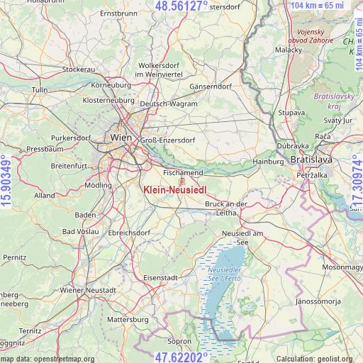
Klein-Neusiedl GPS coordinates[2]
48° 5' 37.644" North, 16° 36' 23.796" East
| Map corner | latitude | longitude |
|---|---|---|
| Upper-left | 48.56127°, | 15.90349° |
| Center: | 48.09379°, | 16.60661° |
| Lower-right: | 47.62202°, | 17.30974° |
| Map W x H: | 104.4×104.4 km | = 64.9×64.9mi |
| max Lat: | 48.98333° ⇑27.7% North |
| Klein-Neusiedl: | 48.09379° |
| min Lat: | ⇓72.3% South 46.48841° |
| min Long | Klein-Neusiedl | max Long |
| 9.57802° | 16.60661° | 17.1° |
| W 96%⇐ | ⇒4% E |
Elevation
Elevation of Klein-Neusiedl is 157 m = 515 ft, and this is 348.5 m = 1143 ft below average elevation for this country.
| Max E: |
2140 m = 7021 ft | 97.7% |
| Avg. | 505.5 m = 1658 ft | |
| Klein-Neusiedl | 157 m = 515 ft | |
Min E: |
118 m = 387 ft | 2.3% |
See also: Austria elevation on elevation.city.
Geographical zone
Klein-Neusiedl is located in North temperate zone (between Tropic of Cancer and the Arctic Circle). Distance of this North polar circle is 2053.6 km =1276 mi to North.| Distance of | km | miles | from Klein-Neusiedl |
|---|---|---|---|
| North Pole | 4659.5 | 2895.3 | to North |
| Arctic Circle | 2053.6 | 1276 | to North |
| Tropic Cancer | 2741.6 | 1703.6 | to South |
| Equator | 5347.5 | 3322.8 | to South |


Nearby cities:
15 places around Klein-Neusiedl: (largest is in red/bold)
• Arbesthal
7.6 km =4.7 mi,  113°
113°
• Ebergassing
8.5 km =5.3 mi,  231°
231°
• Enzersdorf an der Fischa
1 km =0.6 mi,  172°
172°
• Fischamend Dorf
3.1 km =1.9 mi,  353°
353°
• Fischamend-Markt
2.6 km =1.6 mi, 349°
• Gallbrunn
5.3 km =3.3 mi,  157°
157°
• Mannsdorf an der Donau
7.8 km =4.8 mi,  33°
33°
• Margarethen am Moos
6.7 km =4.2 mi,  184°
184°
• Maria Ellend
5.7 km =3.5 mi,  83°
83°
• Probstdorf
8.6 km =5.3 mi,  4°
4°
• Rauchenwarth
6 km =3.7 mi,  258°
258°
• Schwadorf
3.4 km =2.1 mi,  216°
216°
• Stixneusiedl
8.1 km =5 mi,  146°
146°
• Trautmannsdorf an der Leitha
8 km =5 mi, 166°
• Wienerherberg
5.6 km =3.5 mi, 226°
Sources, notices
• [Note1] Compared only with cities in Austria existing in our database
• [Src1] Map data: © OpenStreetMap contributors (CC-BY-SA)
• [Src2] Other city data from geonames.org with taken over terms of usage.
• [Src3] Geographical zone / Annual Mean Temperature by Robert A. Rohde @ Wikipedia
