Wienerherberg geodata
Wienerherberg (Lower Austria) is a populated place; located in Austria in Europe/Vienna (GMT+2) time zone. With population of 814 people, there are 1589 cities with bigger population in this country. Compared to other cities in Austria, 70.2% of cities are located further ↓South; 95.1% of cities are located further ←West and 96.6% of cities have higher elevation than Wienerherberg. Note1
Administrative division(s):
- Level 1: Lower Austria
- Level 2: Politischer Bezirk Bruck an der Leitha
- Level 3: Ebergassing


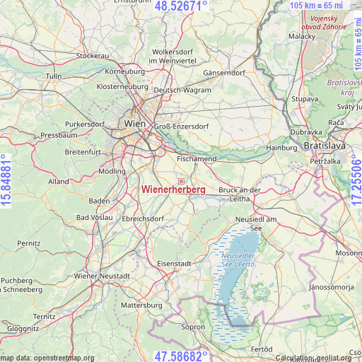
Wienerherberg GPS coordinates[2]
48° 3' 32.076" North, 16° 33' 6.948" East
| Map corner | latitude | longitude |
|---|---|---|
| Upper-left | 48.52671°, | 15.84881° |
| Center: | 48.05891°, | 16.55193° |
| Lower-right: | 47.58682°, | 17.25506° |
| Map W x H: | 104.5×104.5 km | = 64.9×64.9mi |
| max Lat: | 48.98333° ⇑29.8% North |
| Wienerherberg: | 48.05891° |
| min Lat: | ⇓70.2% South 46.48841° |
| min Long | Wienerherberg | max Long |
| 9.57802° | 16.55193° | 17.1° |
| W 95.1%⇐ | ⇒4.9% E |
Elevation
Elevation of Wienerherberg is 167 m = 548 ft, and this is 338.5 m = 1111 ft below average elevation for this country.
| Max E: |
2140 m = 7021 ft | 96.6% |
| Avg. | 505.5 m = 1658 ft | |
| Wienerherberg | 167 m = 548 ft | |
Min E: |
118 m = 387 ft | 3.4% |
See also: Austria elevation on elevation.city.
Geographical zone
Wienerherberg is located in North temperate zone (between Tropic of Cancer and the Arctic Circle). Distance of this North polar circle is 2057.5 km =1278.5 mi to North.| Distance of | km | miles | from Wienerherberg |
|---|---|---|---|
| North Pole | 4663.4 | 2897.7 | to North |
| Arctic Circle | 2057.5 | 1278.5 | to North |
| Tropic Cancer | 2737.7 | 1701.1 | to South |
| Equator | 5343.6 | 3320.4 | to South |


Nearby cities:
15 places around Wienerherberg: (largest is in red/bold)
• Ebergassing
3 km =1.9 mi,  240°
240°
• Enzersdorf an der Fischa
5.1 km =3.2 mi,  55°
55°
• Fischamend Dorf
7.9 km =4.9 mi,  28°
28°
• Fischamend-Markt
7.3 km =4.5 mi, 29°
• Gallbrunn
6.1 km =3.8 mi,  99°
99°
• Gramatneusiedl
5.6 km =3.5 mi, 235°
• Götzendorf an der Leitha
5.2 km =3.2 mi,  153°
153°
• Klein-Neusiedl
5.6 km =3.5 mi,  46°
46°
• Margarethen am Moos
4.6 km =2.9 mi,  128°
128°
• Pischelsdorf
6.6 km =4.1 mi,  170°
170°
• Rauchenwarth
3.2 km =2 mi,  326°
326°
• Reisenberg
7.6 km =4.7 mi,  198°
198°
• Schwadorf
2.4 km =1.5 mi, 60°
• Trautmannsdorf an der Leitha
7.2 km =4.5 mi,  123°
123°
• Wasenbruck
8 km =5 mi,  176°
176°
Sources, notices
• [Note1] Compared only with cities in Austria existing in our database
• [Src1] Map data: © OpenStreetMap contributors (CC-BY-SA)
• [Src2] Other city data from geonames.org with taken over terms of usage.
• [Src3] Geographical zone / Annual Mean Temperature by Robert A. Rohde @ Wikipedia
