Fischamend-Markt geodata
Fischamend-Markt (Lower Austria) is a section of populated place; located in Austria in Europe/Vienna (GMT+2) time zone. With population of 4,688 people, there are 208 cities with bigger population in this country. Compared to other cities in Austria, 73.6% of cities are located further ↓South; 95.8% of cities are located further ←West and 97.4% of cities have higher elevation than Fischamend-Markt. Note1
Administrative division(s):
- Level 1: Lower Austria
- Level 2: Politischer Bezirk Bruck an der Leitha
- Level 3: Fischamend


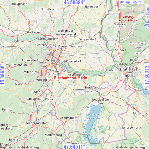
Fischamend-Markt GPS coordinates[2]
48° 7' 0.012" North, 16° 36' 0" East
| Map corner | latitude | longitude |
|---|---|---|
| Upper-left | 48.58394°, | 15.89688° |
| Center: | 48.11667°, | 16.6° |
| Lower-right: | 47.64511°, | 17.30313° |
| Map W x H: | 104.4×104.4 km | = 64.9×64.9mi |
| max Lat: | 48.98333° ⇑26.4% North |
| Fischamend-Markt: | 48.11667° |
| min Lat: | ⇓73.6% South 46.48841° |
| min Long | Fischamend-Mark | max Long |
| 9.57802° | 16.6° | 17.1° |
| W 95.8%⇐ | ⇒4.2% E |
Elevation
Elevation of Fischamend-Markt is 159 m = 522 ft, and this is 346.5 m = 1137 ft below average elevation for this country.
| Max E: |
2140 m = 7021 ft | 97.4% |
| Avg. | 505.5 m = 1658 ft | |
| Fischamend-Markt | 159 m = 522 ft | |
Min E: |
118 m = 387 ft | 2.6% |
See also: Austria elevation on elevation.city.
Geographical zone
Fischamend-Markt is located in North temperate zone (between Tropic of Cancer and the Arctic Circle). Distance of this North polar circle is 2051.1 km =1274.5 mi to North.| Distance of | km | miles | from Fischamend-Markt |
|---|---|---|---|
| North Pole | 4657 | 2893.7 | to North |
| Arctic Circle | 2051.1 | 1274.5 | to North |
| Tropic Cancer | 2744.2 | 1705.2 | to South |
| Equator | 5350.1 | 3324.4 | to South |


Nearby cities:
15 places around Fischamend-Markt: (largest is in red/bold)
• Enzersdorf an der Fischa
3.6 km =2.2 mi,  170°
170°
• Fischamend Dorf
0.5 km =0.3 mi,  14°
14°
• Gallbrunn
7.8 km =4.8 mi,  161°
161°
• Haslau an der Donau
8.7 km =5.4 mi,  90°
90°
• Klein-Neusiedl
2.6 km =1.6 mi, 169°
• Mannsdorf an der Donau
6.2 km =3.9 mi,  50°
50°
• Mannswörth
7.2 km =4.5 mi,  296°
296°
• Maria Ellend
6.5 km =4 mi,  106°
106°
• Oberhausen
6.8 km =4.2 mi,  350°
350°
• Orth an der Donau
8.1 km =5 mi,  67°
67°
• Probstdorf
6.1 km =3.8 mi, 11°
• Rauchenwarth
6.5 km =4 mi,  235°
235°
• Schwadorf
5.5 km =3.4 mi,  196°
196°
• Wienerherberg
7.3 km =4.5 mi,  209°
209°
• Wittau
7.2 km =4.5 mi,  358°
358°
Sources, notices
• [Note1] Compared only with cities in Austria existing in our database
• [Src1] Map data: © OpenStreetMap contributors (CC-BY-SA)
• [Src2] Other city data from geonames.org with taken over terms of usage.
• [Src3] Geographical zone / Annual Mean Temperature by Robert A. Rohde @ Wikipedia
