Mitterndorf geodata
Mitterndorf (Tyrol) is a section of populated place; located in Austria in Europe/Vienna (GMT+2) time zone. With population of 1,938 people, there are 637 cities with bigger population in this country. Compared to other cities in Austria, 50.6% of cities are located further ↑North; 87.7% of cities are located further →East and 56% of cities have lower elevation than Mitterndorf. Note1


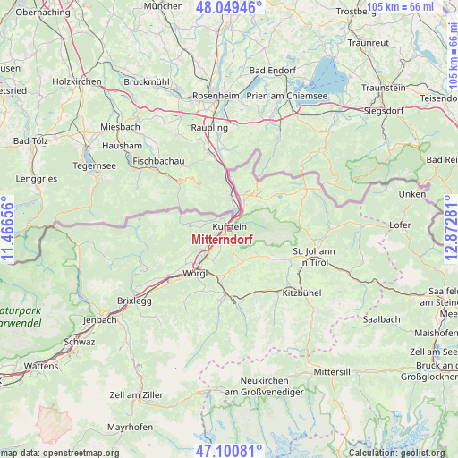
Mitterndorf GPS coordinates[2]
47° 34' 38.208" North, 12° 10' 10.848" East
| Map corner | latitude | longitude |
|---|---|---|
| Upper-left | 48.04946°, | 11.46656° |
| Center: | 47.57728°, | 12.16968° |
| Lower-right: | 47.10081°, | 12.87281° |
| Map W x H: | 105.5×105.5 km | = 65.6×65.6mi |
| max Lat: | 48.98333° ⇑50.6% North |
| Mitterndorf: | 47.57728° |
| min Lat: | ⇓49.4% South 46.48841° |
| min Long | Mitterndorf | max Long |
| 9.57802° | 12.16968° | 17.1° |
| W 12.3%⇐ | ⇒87.7% E |
Elevation
Elevation of Mitterndorf is 492 m = 1614 ft, and this is 13.5 m = 44 ft below average elevation for this country.
| Max E: |
2140 m = 7021 ft | 44% |
| Avg. | 505.5 m = 1658 ft | |
| Mitterndorf | 492 m = 1614 ft | |
Min E: |
118 m = 387 ft | 56% |
See also: Austria elevation on elevation.city.
Geographical zone
Mitterndorf is located in North temperate zone (between Tropic of Cancer and the Arctic Circle). Distance of this North polar circle is 2111.1 km =1311.8 mi to North.| Distance of | km | miles | from Mitterndorf |
|---|---|---|---|
| North Pole | 4717 | 2931 | to North |
| Arctic Circle | 2111.1 | 1311.8 | to North |
| Tropic Cancer | 2684.2 | 1667.9 | to South |
| Equator | 5290.1 | 3287.1 | to South |


Nearby cities:
15 places around Mitterndorf: (largest is in red/bold)
• Ebbs
7.2 km =4.5 mi,  29°
29°
• Eichelwang
2.8 km =1.7 mi, 26°
• Endach
1.5 km =0.9 mi,  224°
224°
• Hinterthiersee
7.8 km =4.8 mi,  274°
274°
• Kufstein
0.7 km =0.4 mi,  341°
341°
• Langkampfen
6 km =3.7 mi,  238°
238°
• Mitterland
5.6 km =3.5 mi,  280°
280°
• Oberndorf
5.6 km =3.5 mi,  38°
38°
• Scheffau am Wilden Kaiser
8.1 km =5 mi,  130°
130°
• Schwoich
4.1 km =2.5 mi,  212°
212°
• Thiersee
4.3 km =2.7 mi,  295°
295°
• Unterlangkampfen
6 km =3.7 mi, 239°
• Vorderthiersee
5.3 km =3.3 mi, 277°
• Weissach
0.9 km =0.6 mi, 217°
• Zell
1.6 km =1 mi,  294°
294°
Sources, notices
• [Note1] Compared only with cities in Austria existing in our database
• [Src1] Map data: © OpenStreetMap contributors (CC-BY-SA)
• [Src2] Other city data from geonames.org with taken over terms of usage.
• [Src3] Geographical zone / Annual Mean Temperature by Robert A. Rohde @ Wikipedia
