Schwoich geodata
Schwoich (Tyrol) is a seat of a third-order administrative division; located in Austria in Europe/Vienna (GMT+2) time zone. With population of 2,515 people, there are 474 cities with bigger population in this country. Compared to other cities in Austria, 51.7% of cities are located further ↑North; 87.9% of cities are located further →East and 68% of cities have lower elevation than Schwoich. Note1


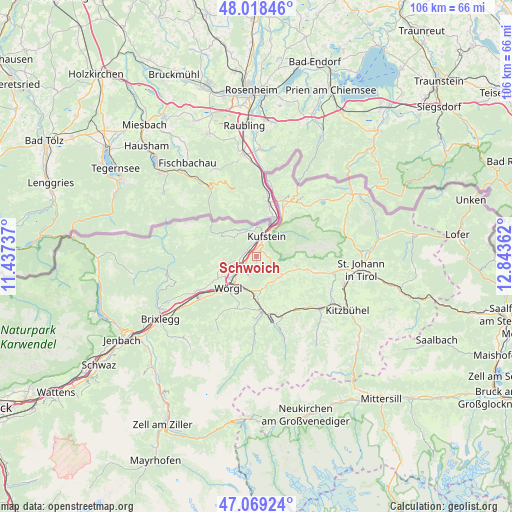
Schwoich GPS coordinates[2]
47° 32' 45.6" North, 12° 8' 25.764" East
| Map corner | latitude | longitude |
|---|---|---|
| Upper-left | 48.01846°, | 11.43737° |
| Center: | 47.546°, | 12.14049° |
| Lower-right: | 47.06924°, | 12.84362° |
| Map W x H: | 105.5×105.5 km | = 65.6×65.6mi |
| max Lat: | 48.98333° ⇑51.7% North |
| Schwoich: | 47.546° |
| min Lat: | ⇓48.3% South 46.48841° |
| min Long | Schwoich | max Long |
| 9.57802° | 12.14049° | 17.1° |
| W 12.1%⇐ | ⇒87.9% E |
Elevation
Elevation of Schwoich is 571 m = 1873 ft, and this is 65.5 m = 215 ft above average elevation for this country.
| Max E: |
2140 m = 7021 ft | 32% |
| Schwoich | 571 m 1873 ft | |
| Avg. | 505.5 m = 1658 ft | |
Min E: |
118 m = 387 ft | 68% |
See also: Austria elevation on elevation.city.
Geographical zone
Schwoich is located in North temperate zone (between Tropic of Cancer and the Arctic Circle). Distance of this North polar circle is 2114.6 km =1314 mi to North.| Distance of | km | miles | from Schwoich |
|---|---|---|---|
| North Pole | 4720.4 | 2933.1 | to North |
| Arctic Circle | 2114.6 | 1314 | to North |
| Tropic Cancer | 2680.7 | 1665.7 | to South |
| Equator | 5286.6 | 3284.9 | to South |


Nearby cities:
15 places around Schwoich: (largest is in red/bold)
• Bad Häring
4.2 km =2.6 mi,  202°
202°
• Endach
2.7 km =1.7 mi,  25°
25°
• Kirchbichl
4.6 km =2.9 mi,  226°
226°
• Kufstein
4.6 km =2.9 mi, 25°
• Langkampfen
3 km =1.9 mi,  275°
275°
• Mitterland
5.6 km =3.5 mi,  323°
323°
• Mitterndorf
4.1 km =2.5 mi, 32°
• Niederbreitenbach
4.5 km =2.8 mi,  251°
251°
• Oberlangkampfen
4.8 km =3 mi, 234°
• Söll
6.1 km =3.8 mi,  140°
140°
• Thiersee
5.6 km =3.5 mi,  342°
342°
• Unterlangkampfen
3.1 km =1.9 mi, 278°
• Vorderthiersee
5.1 km =3.2 mi, 323°
• Weissach
3.2 km =2 mi, 30°
• Zell
4.2 km =2.6 mi,  9°
9°
Sources, notices
• [Note1] Compared only with cities in Austria existing in our database
• [Src1] Map data: © OpenStreetMap contributors (CC-BY-SA)
• [Src2] Other city data from geonames.org with taken over terms of usage.
• [Src3] Geographical zone / Annual Mean Temperature by Robert A. Rohde @ Wikipedia
