Stoneville geodata
Stoneville (Western Australia) is a section of populated place; located in Australia in Australia/Perth (GMT+8) time zone. With population of 2,321 people, there are 2679 cities with bigger population in this country. Compared to other cities in Australia, 67.2% of cities are located further ↓South; 91.3% of cities are located further →East and 84.4% of cities have lower elevation than Stoneville. Note1


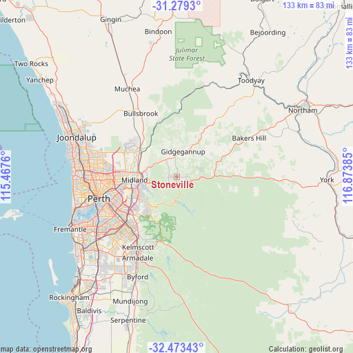
Stoneville GPS coordinates[2]
31° 52' 41.88" South, 116° 10' 14.592" East
| Map corner | latitude | longitude |
|---|---|---|
| Upper-left | -31.2793°, | 115.4676° |
| Center: | -31.8783°, | 116.17072° |
| Lower-right: | -32.47343°, | 116.87385° |
| Map W x H: | 132.8×132.8 km | = 82.5×82.5mi |
| max Lat: | -10.58257° ⇑32.8% North |
| Stoneville: | -31.8783° |
| min Lat: | ⇓67.2% South -43.31423° |
| min Long | Stoneville | max Long |
| 113.53327° | 116.17072° | 153.61246° |
| W 8.7%⇐ | ⇒91.3% E |
Elevation
Elevation of Stoneville is 238 m = 781 ft, and this is 116 m = 381 ft above average elevation for this country.
| Max E: |
1715 m = 5627 ft | 15.6% |
| Stoneville | 238 m 781 ft | |
| Avg. | 122 m = 400 ft | |
Min E: |
-2 m = -7 ft | 84.4% |
See also: Australia elevation on elevation.city.
Geographical zone
Stoneville is located in South temperate zone (between Tropic of Capricorn and the Antarctic Circle). Distance of this Southern Tropic circle is 938.6 km =583.2 mi to North.| Distance of | km | miles | from Stoneville |
|---|---|---|---|
| Equator | 3544.5 | 2202.4 | to North |
| Tropic Capricorn | 938.6 | 583.2 | to North |
| Antarctic Circle | 3856.6 | 2396.4 | to South |
| South Pole | 6462.5 | 4015.6 | to South |


Nearby cities:
15 places around Stoneville: (largest is in red/bold)
• Boya
11.6 km =7.2 mi,  246°
246°
• Chidlow
9.8 km =6.1 mi,  78°
78°
• Darlington
9.6 km =6 mi,  241°
241°
• Glen Forrest
7.5 km =4.7 mi,  232°
232°
• Greenmount
11.7 km =7.3 mi,  257°
257°
• Hovea
6.7 km =4.2 mi,  265°
265°
• Jane Brook
11.5 km =7.1 mi,  278°
278°
• Koongamia
12.5 km =7.8 mi, 255°
• Mahogany Creek
4.4 km =2.7 mi, 226°
• Mount Helena
3.7 km =2.3 mi,  86°
86°
• Mundaring
2.7 km =1.7 mi,  186°
186°
• Parkerville
3.1 km =1.9 mi, 277°
• Sawyers Valley
3.9 km =2.4 mi,  133°
133°
• Stratton
12.3 km =7.6 mi, 275°
• Swan View
11.4 km =7.1 mi, 267°
Sources, notices
• [Note1] Compared only with cities in Australia existing in our database
• [Src1] Map data: © OpenStreetMap contributors (CC-BY-SA)
• [Src2] Other city data from geonames.org with taken over terms of usage.
• [Src3] Geographical zone / Annual Mean Temperature by Robert A. Rohde @ Wikipedia
