Seaford geodata
Seaford (South Australia) is a section of populated place; located in Australia in Australia/Adelaide (GMT+10.5) time zone. With population of 4,316 people, there are 1675 cities with bigger population in this country. Compared to other cities in Australia, 74.2% of cities are located further ↑North; 84.9% of cities are located further →East and 62.8% of cities have higher elevation than Seaford. Note1


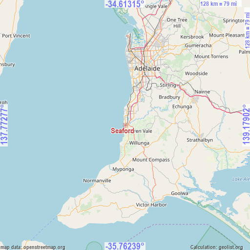
Seaford GPS coordinates[2]
35° 11' 23.28" South, 138° 28' 33.204" East
| Map corner | latitude | longitude |
|---|---|---|
| Upper-left | -34.61315°, | 137.77277° |
| Center: | -35.1898°, | 138.47589° |
| Lower-right: | -35.76239°, | 139.17902° |
| Map W x H: | 127.8×127.8 km | = 79.4×79.4mi |
| max Lat: | -10.58257° ⇑74.2% North |
| Seaford: | -35.1898° |
| min Lat: | ⇓25.8% South -43.31423° |
| min Long | Seaford | max Long |
| 113.53327° | 138.47589° | 153.61246° |
| W 15.1%⇐ | ⇒84.9% E |
Elevation
Elevation of Seaford is 29 m = 95 ft, and this is 93 m = 305 ft below average elevation for this country.
| Max E: |
1715 m = 5627 ft | 62.8% |
| Avg. | 122 m = 400 ft | |
| Seaford | 29 m = 95 ft | |
Min E: |
-2 m = -7 ft | 37.2% |
See also: Australia elevation on elevation.city.
Geographical zone
Seaford is located in South temperate zone (between Tropic of Capricorn and the Antarctic Circle). Distance of this Southern Tropic circle is 1306.8 km =812 mi to North.| Distance of | km | miles | from Seaford |
|---|---|---|---|
| Equator | 3912.7 | 2431.2 | to North |
| Tropic Capricorn | 1306.8 | 812 | to North |
| Antarctic Circle | 3488.4 | 2167.6 | to South |
| South Pole | 6094.3 | 3786.8 | to South |


Nearby cities:
15 places around Seaford: (largest is in red/bold)
• Christie Downs
6.9 km =4.3 mi,  15°
15°
• Christies Beach
5.7 km =3.5 mi,  356°
356°
• Hackham
5.9 km =3.7 mi,  49°
49°
• Hackham West
6.3 km =3.9 mi,  34°
34°
• Huntfield Heights
5.2 km =3.2 mi,  41°
41°
• Maslin Beach
4 km =2.5 mi,  174°
174°
• McLaren Vale
6.9 km =4.3 mi,  117°
117°
• Moana
0.5 km =0.3 mi,  177°
177°
• Morphett Vale
7.3 km =4.5 mi, 30°
• Noarlunga Downs
5.1 km =3.2 mi, 30°
• Old Noarlunga
2.5 km =1.6 mi,  69°
69°
• Port Noarlunga
4.7 km =2.9 mi,  354°
354°
• Port Noarlunga South
1.9 km =1.2 mi,  339°
339°
• Seaford Meadows
2.2 km =1.4 mi, 29°
• Seaford Rise
0.6 km =0.4 mi, 123°
Sources, notices
• [Note1] Compared only with cities in Australia existing in our database
• [Src1] Map data: © OpenStreetMap contributors (CC-BY-SA)
• [Src2] Other city data from geonames.org with taken over terms of usage.
• [Src3] Geographical zone / Annual Mean Temperature by Robert A. Rohde @ Wikipedia
