Hackham geodata
Hackham (South Australia) is a section of populated place; located in Australia in Australia/Adelaide (GMT+10.5) time zone. With population of 3,884 people, there are 1834 cities with bigger population in this country. Compared to other cities in Australia, 73.7% of cities are located further ↑North; 83.8% of cities are located further →East and 63.7% of cities have lower elevation than Hackham. Note1


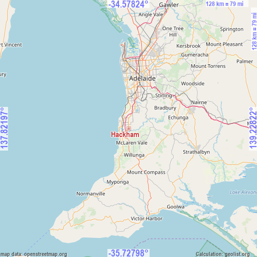
Hackham GPS coordinates[2]
35° 9' 18.504" South, 138° 31' 30.324" East
| Map corner | latitude | longitude |
|---|---|---|
| Upper-left | -34.57824°, | 137.82197° |
| Center: | -35.15514°, | 138.52509° |
| Lower-right: | -35.72798°, | 139.22822° |
| Map W x H: | 127.8×127.8 km | = 79.4×79.4mi |
| max Lat: | -10.58257° ⇑73.7% North |
| Hackham: | -35.15514° |
| min Lat: | ⇓26.3% South -43.31423° |
| min Long | Hackham | max Long |
| 113.53327° | 138.52509° | 153.61246° |
| W 16.2%⇐ | ⇒83.8% E |
Elevation
Elevation of Hackham is 75 m = 246 ft, and this is 47 m = 154 ft below average elevation for this country.
| Max E: |
1715 m = 5627 ft | 36.3% |
| Avg. | 122 m = 400 ft | |
| Hackham | 75 m = 246 ft | |
Min E: |
-2 m = -7 ft | 63.7% |
See also: Australia elevation on elevation.city.
Geographical zone
Hackham is located in South temperate zone (between Tropic of Capricorn and the Antarctic Circle). Distance of this Southern Tropic circle is 1303 km =809.6 mi to North.| Distance of | km | miles | from Hackham |
|---|---|---|---|
| Equator | 3908.9 | 2428.9 | to North |
| Tropic Capricorn | 1303 | 809.6 | to North |
| Antarctic Circle | 3492.3 | 2170 | to South |
| South Pole | 6098.2 | 3789.2 | to South |


Nearby cities:
15 places around Hackham: (largest is in red/bold)
• Christie Downs
3.8 km =2.4 mi,  316°
316°
• Christies Beach
5.1 km =3.2 mi,  290°
290°
• Hackham West
1.7 km =1.1 mi, 324°
• Huntfield Heights
1 km =0.6 mi,  273°
273°
• Moana
6.2 km =3.9 mi,  225°
225°
• Morphett Vale
2.5 km =1.6 mi,  342°
342°
• Noarlunga Downs
2 km =1.2 mi, 285°
• Old Noarlunga
3.7 km =2.3 mi,  215°
215°
• Old Reynella
5.8 km =3.6 mi,  7°
7°
• Onkaparinga Hills
4.4 km =2.7 mi,  59°
59°
• Port Noarlunga
5 km =3.1 mi,  279°
279°
• Port Noarlunga South
5.5 km =3.4 mi,  247°
247°
• Seaford
5.9 km =3.7 mi, 229°
• Seaford Meadows
3.9 km =2.4 mi,  239°
239°
• Seaford Rise
5.8 km =3.6 mi, 223°
Sources, notices
• [Note1] Compared only with cities in Australia existing in our database
• [Src1] Map data: © OpenStreetMap contributors (CC-BY-SA)
• [Src2] Other city data from geonames.org with taken over terms of usage.
• [Src3] Geographical zone / Annual Mean Temperature by Robert A. Rohde @ Wikipedia
