Scarborough geodata
Scarborough (Western Australia) is a section of populated place; located in Australia in Australia/Perth (GMT+8) time zone. With population of 15,258 people, there are 266 cities with bigger population in this country. Compared to other cities in Australia, 66.8% of cities are located further ↓South; 97% of cities are located further →East and 90.1% of cities have higher elevation than Scarborough. Note1


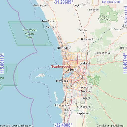
Scarborough GPS coordinates[2]
31° 53' 44.808" South, 115° 45' 51.516" East
| Map corner | latitude | longitude |
|---|---|---|
| Upper-left | -31.29689°, | 115.06119° |
| Center: | -31.89578°, | 115.76431° |
| Lower-right: | -32.4908°, | 116.46744° |
| Map W x H: | 132.8×132.8 km | = 82.5×82.5mi |
| max Lat: | -10.58257° ⇑33.2% North |
| Scarborough: | -31.89578° |
| min Lat: | ⇓66.8% South -43.31423° |
| min Long | Scarborough | max Long |
| 113.53327° | 115.76431° | 153.61246° |
| W 3%⇐ | ⇒97% E |
Elevation
Elevation of Scarborough is 9 m = 30 ft, and this is 113 m = 371 ft below average elevation for this country.
| Max E: |
1715 m = 5627 ft | 90.1% |
| Avg. | 122 m = 400 ft | |
| Scarborough | 9 m = 30 ft | |
Min E: |
-2 m = -7 ft | 9.9% |
See also: Australia elevation on elevation.city.
Geographical zone
Scarborough is located in South temperate zone (between Tropic of Capricorn and the Antarctic Circle). Distance of this Southern Tropic circle is 940.6 km =584.5 mi to North.| Distance of | km | miles | from Scarborough |
|---|---|---|---|
| Equator | 3546.5 | 2203.7 | to North |
| Tropic Capricorn | 940.6 | 584.5 | to North |
| Antarctic Circle | 3854.7 | 2395.2 | to South |
| South Pole | 6460.6 | 4014.4 | to South |


Nearby cities:
15 places around Scarborough: (largest is in red/bold)
• Carine
5.1 km =3.2 mi,  19°
19°
• Churchlands
3.9 km =2.4 mi,  136°
136°
• City Beach
4.3 km =2.7 mi,  183°
183°
• Doubleview
1.6 km =1 mi,  91°
91°
• Floreat
5.4 km =3.4 mi,  151°
151°
• Glendalough
5.9 km =3.7 mi,  117°
117°
• Gwelup
3.9 km =2.4 mi,  47°
47°
• Innaloo
2.9 km =1.8 mi,  83°
83°
• Karrinyup
2.9 km =1.8 mi, 24°
• North Beach
3.7 km =2.3 mi,  348°
348°
• Osborne Park
4.4 km =2.7 mi,  97°
97°
• Stirling
4.5 km =2.8 mi,  72°
72°
• Trigg
3 km =1.9 mi, 346°
• Watermans Bay
5.2 km =3.2 mi, 351°
• Wembley Downs
2 km =1.2 mi, 153°
Sources, notices
• [Note1] Compared only with cities in Australia existing in our database
• [Src1] Map data: © OpenStreetMap contributors (CC-BY-SA)
• [Src2] Other city data from geonames.org with taken over terms of usage.
• [Src3] Geographical zone / Annual Mean Temperature by Robert A. Rohde @ Wikipedia
