Roleystone geodata
Roleystone (Western Australia) is a section of populated place; located in Australia in Australia/Perth (GMT+8) time zone. With population of 6,425 people, there are 1093 cities with bigger population in this country. Compared to other cities in Australia, 63.4% of cities are located further ↓South; 91.6% of cities are located further →East and 83.2% of cities have lower elevation than Roleystone. Note1


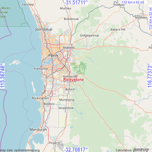
Roleystone GPS coordinates[2]
32° 6' 52.488" South, 116° 4' 14.16" East
| Map corner | latitude | longitude |
|---|---|---|
| Upper-left | -31.51711°, | 115.36748° |
| Center: | -32.11458°, | 116.0706° |
| Lower-right: | -32.70817°, | 116.77373° |
| Map W x H: | 132.4×132.4 km | = 82.3×82.3mi |
| max Lat: | -10.58257° ⇑36.6% North |
| Roleystone: | -32.11458° |
| min Lat: | ⇓63.4% South -43.31423° |
| min Long | Roleystone | max Long |
| 113.53327° | 116.0706° | 153.61246° |
| W 8.4%⇐ | ⇒91.6% E |
Elevation
Elevation of Roleystone is 220 m = 722 ft, and this is 98 m = 322 ft above average elevation for this country.
| Max E: |
1715 m = 5627 ft | 16.8% |
| Roleystone | 220 m 722 ft | |
| Avg. | 122 m = 400 ft | |
Min E: |
-2 m = -7 ft | 83.2% |
See also: Australia elevation on elevation.city.
Geographical zone
Roleystone is located in South temperate zone (between Tropic of Capricorn and the Antarctic Circle). Distance of this Southern Tropic circle is 964.9 km =599.6 mi to North.| Distance of | km | miles | from Roleystone |
|---|---|---|---|
| Equator | 3570.8 | 2218.8 | to North |
| Tropic Capricorn | 964.9 | 599.6 | to North |
| Antarctic Circle | 3830.4 | 2380.1 | to South |
| South Pole | 6436.3 | 3999.3 | to South |


Nearby cities:
15 places around Roleystone: (largest is in red/bold)
• Armadale
6.8 km =4.2 mi,  238°
238°
• Bedfordale
6.9 km =4.3 mi,  196°
196°
• Brookdale
8.7 km =5.4 mi,  227°
227°
• Camillo
6.5 km =4 mi,  271°
271°
• Champion Lakes
8 km =5 mi, 266°
• Gosnells
7.2 km =4.5 mi,  301°
301°
• Haynes
9.9 km =6.2 mi, 237°
• Hilbert
10.7 km =6.6 mi, 228°
• Huntingdale
10.4 km =6.5 mi,  289°
289°
• Kelmscott
4.3 km =2.7 mi,  255°
255°
• Martin
5 km =3.1 mi,  331°
331°
• Mount Nasura
5 km =3.1 mi, 239°
• Mount Richon
8 km =5 mi,  215°
215°
• Seville Grove
8.1 km =5 mi,  252°
252°
• Southern River
10.6 km =6.6 mi, 274°
Sources, notices
• [Note1] Compared only with cities in Australia existing in our database
• [Src1] Map data: © OpenStreetMap contributors (CC-BY-SA)
• [Src2] Other city data from geonames.org with taken over terms of usage.
• [Src3] Geographical zone / Annual Mean Temperature by Robert A. Rohde @ Wikipedia
