Seaham geodata
Seaham (New South Wales) is a section of populated place; located in Australia in Australia/Sydney (GMT+11) time zone. With population of 989 people, there are 3841 cities with bigger population in this country. Compared to other cities in Australia, 60.8% of cities are located further ↓South; 80.8% of cities are located further ←West and 80.4% of cities have higher elevation than Seaham. Note1


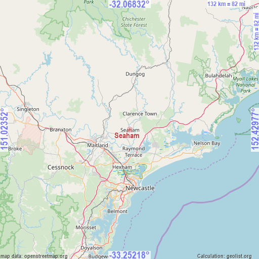
Seaham GPS coordinates[2]
32° 39' 43.956" South, 151° 43' 35.904" East
| Map corner | latitude | longitude |
|---|---|---|
| Upper-left | -32.06832°, | 151.02352° |
| Center: | -32.66221°, | 151.72664° |
| Lower-right: | -33.25218°, | 152.42977° |
| Map W x H: | 131.6×131.6 km | = 81.8×81.8mi |
| max Lat: | -10.58257° ⇑39.2% North |
| Seaham: | -32.66221° |
| min Lat: | ⇓60.8% South -43.31423° |
| min Long | Seaham | max Long |
| 113.53327° | 151.72664° | 153.61246° |
| W 80.8%⇐ | ⇒19.2% E |
Elevation
Elevation of Seaham is 15 m = 49 ft, and this is 107 m = 351 ft below average elevation for this country.
| Max E: |
1715 m = 5627 ft | 80.4% |
| Avg. | 122 m = 400 ft | |
| Seaham | 15 m = 49 ft | |
Min E: |
-2 m = -7 ft | 19.6% |
See also: Australia elevation on elevation.city.
Geographical zone
Seaham is located in South temperate zone (between Tropic of Capricorn and the Antarctic Circle). Distance of this Southern Tropic circle is 1025.8 km =637.4 mi to North.| Distance of | km | miles | from Seaham |
|---|---|---|---|
| Equator | 3631.7 | 2256.6 | to North |
| Tropic Capricorn | 1025.8 | 637.4 | to North |
| Antarctic Circle | 3769.5 | 2342.3 | to South |
| South Pole | 6375.4 | 3961.5 | to South |


Nearby cities:
15 places around Seaham: (largest is in red/bold)
• Bolwarra Heights
13.9 km =8.6 mi,  251°
251°
• Brandy Hill
4.2 km =2.6 mi,  223°
223°
• Clarence Town
9.9 km =6.2 mi,  28°
28°
• Duns Creek
9.3 km =5.8 mi,  290°
290°
• Heatherbrae
14.1 km =8.8 mi,  176°
176°
• Largs
12.6 km =7.8 mi, 250°
• Metford
15.8 km =9.8 mi, 223°
• Morpeth
11.8 km =7.3 mi,  227°
227°
• Nelsons Plains
9.6 km =6 mi, 175°
• Paterson
12.1 km =7.5 mi,  301°
301°
• Raworth
13 km =8.1 mi, 232°
• Raymond Terrace
11 km =6.8 mi,  168°
168°
• Tenambit
13.7 km =8.5 mi, 231°
• Wallalong
8.1 km =5 mi,  242°
242°
• Woodberry
15.3 km =9.5 mi,  197°
197°
Sources, notices
• [Note1] Compared only with cities in Australia existing in our database
• [Src1] Map data: © OpenStreetMap contributors (CC-BY-SA)
• [Src2] Other city data from geonames.org with taken over terms of usage.
• [Src3] Geographical zone / Annual Mean Temperature by Robert A. Rohde @ Wikipedia
