Brandy Hill geodata
Brandy Hill (New South Wales) is a section of populated place; located in Australia in Australia/Sydney (GMT+11) time zone. With population of 650 people, there are 4441 cities with bigger population in this country. Compared to other cities in Australia, 60.7% of cities are located further ↓South; 80.5% of cities are located further ←West and 59.2% of cities have higher elevation than Brandy Hill. Note1


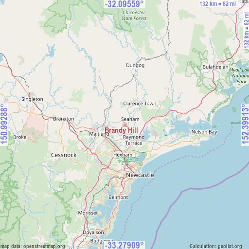
Brandy Hill GPS coordinates[2]
32° 41' 21.48" South, 151° 41' 45.6" East
| Map corner | latitude | longitude |
|---|---|---|
| Upper-left | -32.09559°, | 150.99288° |
| Center: | -32.6893°, | 151.696° |
| Lower-right: | -33.27909°, | 152.39913° |
| Map W x H: | 131.6×131.6 km | = 81.8×81.8mi |
| max Lat: | -10.58257° ⇑39.3% North |
| Brandy Hill: | -32.6893° |
| min Lat: | ⇓60.7% South -43.31423° |
| min Long | Brandy Hill | max Long |
| 113.53327° | 151.696° | 153.61246° |
| W 80.5%⇐ | ⇒19.5% E |
Elevation
Elevation of Brandy Hill is 33 m = 108 ft, and this is 89 m = 292 ft below average elevation for this country.
| Max E: |
1715 m = 5627 ft | 59.2% |
| Avg. | 122 m = 400 ft | |
| Brandy Hill | 33 m = 108 ft | |
Min E: |
-2 m = -7 ft | 40.8% |
See also: Australia elevation on elevation.city.
Geographical zone
Brandy Hill is located in South temperate zone (between Tropic of Capricorn and the Antarctic Circle). Distance of this Southern Tropic circle is 1028.8 km =639.3 mi to North.| Distance of | km | miles | from Brandy Hill |
|---|---|---|---|
| Equator | 3634.7 | 2258.5 | to North |
| Tropic Capricorn | 1028.8 | 639.3 | to North |
| Antarctic Circle | 3766.5 | 2340.4 | to South |
| South Pole | 6372.4 | 3959.6 | to South |


Nearby cities:
15 places around Brandy Hill: (largest is in red/bold)
• Bolwarra Heights
10.4 km =6.5 mi,  262°
262°
• Duns Creek
8.6 km =5.3 mi,  316°
316°
• Heatherbrae
11.7 km =7.3 mi,  161°
161°
• Largs
9.1 km =5.7 mi, 262°
• Metford
11.7 km =7.3 mi,  223°
223°
• Morpeth
7.6 km =4.7 mi,  230°
230°
• Nelsons Plains
7.5 km =4.7 mi,  151°
151°
• Paterson
11.9 km =7.4 mi, 320°
• Raworth
8.9 km =5.5 mi,  236°
236°
• Raymond Terrace
9.3 km =5.8 mi, 146°
• Seaham
4.2 km =2.6 mi,  43°
43°
• Tenambit
9.6 km =6 mi, 234°
• Thornton
12 km =7.5 mi,  209°
209°
• Wallalong
4.4 km =2.7 mi, 260°
• Woodberry
11.7 km =7.3 mi,  188°
188°
Sources, notices
• [Note1] Compared only with cities in Australia existing in our database
• [Src1] Map data: © OpenStreetMap contributors (CC-BY-SA)
• [Src2] Other city data from geonames.org with taken over terms of usage.
• [Src3] Geographical zone / Annual Mean Temperature by Robert A. Rohde @ Wikipedia
