Sarsfield geodata
Sarsfield (Victoria) is a populated place; located in Australia in Australia/Melbourne (GMT+11) time zone. With population of 603 people, there are 4557 cities with bigger population in this country. Compared to other cities in Australia, 86.1% of cities are located further ↑North; 50.6% of cities are located further ←West and 55.2% of cities have higher elevation than Sarsfield. Note1


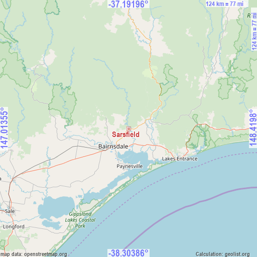
Sarsfield GPS coordinates[2]
37° 45' 0" South, 147° 43' 0.012" East
| Map corner | latitude | longitude |
|---|---|---|
| Upper-left | -37.19196°, | 147.01355° |
| Center: | -37.75°, | 147.71667° |
| Lower-right: | -38.30386°, | 148.4198° |
| Map W x H: | 123.6×123.6 km | = 76.8×76.8mi |
| max Lat: | -10.58257° ⇑86.1% North |
| Sarsfield: | -37.75° |
| min Lat: | ⇓13.9% South -43.31423° |
| min Long | Sarsfield | max Long |
| 113.53327° | 147.71667° | 153.61246° |
| W 50.6%⇐ | ⇒49.4% E |
Elevation
Elevation of Sarsfield is 38 m = 125 ft, and this is 84 m = 276 ft below average elevation for this country.
| Max E: |
1715 m = 5627 ft | 55.2% |
| Avg. | 122 m = 400 ft | |
| Sarsfield | 38 m = 125 ft | |
Min E: |
-2 m = -7 ft | 44.8% |
See also: Australia elevation on elevation.city.
Geographical zone
Sarsfield is located in South temperate zone (between Tropic of Capricorn and the Antarctic Circle). Distance of this Southern Tropic circle is 1591.5 km =988.9 mi to North.| Distance of | km | miles | from Sarsfield |
|---|---|---|---|
| Equator | 4197.4 | 2608.1 | to North |
| Tropic Capricorn | 1591.5 | 988.9 | to North |
| Antarctic Circle | 3203.8 | 1990.7 | to South |
| South Pole | 5809.7 | 3610 | to South |


Nearby cities:
15 places around Sarsfield: (largest is in red/bold)
• Bairnsdale
12.4 km =7.7 mi,  229°
229°
• Bruthen
11.1 km =6.9 mi,  64°
64°
• Eagle Point
16.9 km =10.5 mi,  189°
189°
• East Bairnsdale
10.8 km =6.7 mi,  209°
209°
• Kalimna
25.7 km =16 mi,  121°
121°
• Lake Tyers Beach
33.4 km =20.8 mi,  111°
111°
• Lakes Entrance
28.2 km =17.5 mi, 117°
• Loch Sport
34.1 km =21.2 mi,  198°
198°
• Lucknow
9.4 km =5.8 mi,  218°
218°
• Metung
19.8 km =12.3 mi,  142°
142°
• Newlands Arm
20 km =12.4 mi, 186°
• Nicholson
7.6 km =4.7 mi,  168°
168°
• Paynesville
18.8 km =11.7 mi,  179°
179°
• Swan Reach
16.1 km =10 mi,  125°
125°
• Wy Yung
13 km =8.1 mi,  244°
244°
Sources, notices
• [Note1] Compared only with cities in Australia existing in our database
• [Src1] Map data: © OpenStreetMap contributors (CC-BY-SA)
• [Src2] Other city data from geonames.org with taken over terms of usage.
• [Src3] Geographical zone / Annual Mean Temperature by Robert A. Rohde @ Wikipedia
