Peak Crossing geodata
Peak Crossing (Queensland) is a populated place; located in Australia in Australia/Brisbane (GMT+10) time zone. With population of 946 people, there are 3904 cities with bigger population in this country. Compared to other cities in Australia, 77.2% of cities are located further ↓South; 86% of cities are located further ←West and 60% of cities have lower elevation than Peak Crossing. Note1


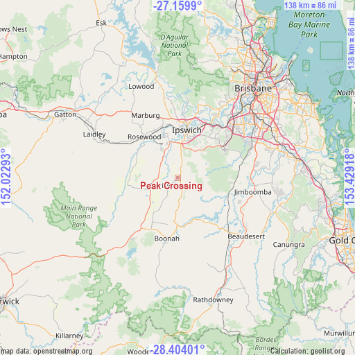
Peak Crossing GPS coordinates[2]
27° 47' 1.428" South, 152° 43' 33.78" East
| Map corner | latitude | longitude |
|---|---|---|
| Upper-left | -27.1599°, | 152.02293° |
| Center: | -27.78373°, | 152.72605° |
| Lower-right: | -28.40401°, | 153.42918° |
| Map W x H: | 138.3×138.3 km | = 85.9×85.9mi |
| max Lat: | -10.58257° ⇑22.8% North |
| Peak Crossing: | -27.78373° |
| min Lat: | ⇓77.2% South -43.31423° |
| min Long | Peak Crossing | max Long |
| 113.53327° | 152.72605° | 153.61246° |
| W 86%⇐ | ⇒14% E |
Elevation
Elevation of Peak Crossing is 64 m = 210 ft, and this is 58 m = 190 ft below average elevation for this country.
| Max E: |
1715 m = 5627 ft | 40% |
| Avg. | 122 m = 400 ft | |
| Peak Crossing | 64 m = 210 ft | |
Min E: |
-2 m = -7 ft | 60% |
See also: Australia elevation on elevation.city.
Geographical zone
Peak Crossing is located in South temperate zone (between Tropic of Capricorn and the Antarctic Circle). Distance of this Southern Tropic circle is 483.3 km =300.3 mi to North.| Distance of | km | miles | from Peak Crossing |
|---|---|---|---|
| Equator | 3089.3 | 1919.6 | to North |
| Tropic Capricorn | 483.3 | 300.3 | to North |
| Antarctic Circle | 4311.9 | 2679.3 | to South |
| South Pole | 6917.8 | 4298.5 | to South |


Nearby cities:
15 places around Peak Crossing: (largest is in red/bold)
• Churchill
15.9 km =9.9 mi,  8°
8°
• Deebing Heights
13.1 km =8.1 mi, 9°
• Eastern Heights
18 km =11.2 mi,  16°
16°
• Flinders View
15.6 km =9.7 mi, 17°
• Harrisville
6.8 km =4.2 mi,  243°
243°
• Ipswich
18.1 km =11.2 mi, 10°
• Leichhardt
17.9 km =11.1 mi,  2°
2°
• New Beith
15.6 km =9.7 mi,  94°
94°
• One Mile
17.2 km =10.7 mi, 3°
• Purga
13.9 km =8.6 mi,  355°
355°
• Raceview
17.3 km =10.7 mi, 16°
• Ripley
12.9 km =8 mi,  54°
54°
• South Ripley
11.6 km =7.2 mi, 50°
• Willowbank
12.4 km =7.7 mi,  335°
335°
• Yamanto
13.8 km =8.6 mi, 5°
Sources, notices
• [Note1] Compared only with cities in Australia existing in our database
• [Src1] Map data: © OpenStreetMap contributors (CC-BY-SA)
• [Src2] Other city data from geonames.org with taken over terms of usage.
• [Src3] Geographical zone / Annual Mean Temperature by Robert A. Rohde @ Wikipedia
