Minden geodata
Minden (Queensland) is a populated place; located in Australia in Australia/Brisbane (GMT+10) time zone. With population of 1,212 people, there are 3564 cities with bigger population in this country. Compared to other cities in Australia, 80.5% of cities are located further ↓South; 84.8% of cities are located further ←West and 70.1% of cities have lower elevation than Minden. Note1


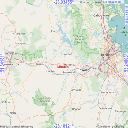
Minden GPS coordinates[2]
27° 33' 34.74" South, 152° 32' 41.748" East
| Map corner | latitude | longitude |
|---|---|---|
| Upper-left | -26.93455°, | 151.84181° |
| Center: | -27.55965°, | 152.54493° |
| Lower-right: | -28.18121°, | 153.24806° |
| Map W x H: | 138.6×138.6 km | = 86.1×86.1mi |
| max Lat: | -10.58257° ⇑19.5% North |
| Minden: | -27.55965° |
| min Lat: | ⇓80.5% South -43.31423° |
| min Long | Minden | max Long |
| 113.53327° | 152.54493° | 153.61246° |
| W 84.8%⇐ | ⇒15.2% E |
Elevation
Elevation of Minden is 104 m = 341 ft, and this is 18 m = 59 ft below average elevation for this country.
| Max E: |
1715 m = 5627 ft | 29.9% |
| Avg. | 122 m = 400 ft | |
| Minden | 104 m = 341 ft | |
Min E: |
-2 m = -7 ft | 70.1% |
See also: Australia elevation on elevation.city.
Geographical zone
Minden is located in South temperate zone (between Tropic of Capricorn and the Antarctic Circle). Distance of this Southern Tropic circle is 458.4 km =284.8 mi to North.| Distance of | km | miles | from Minden |
|---|---|---|---|
| Equator | 3064.3 | 1904.1 | to North |
| Tropic Capricorn | 458.4 | 284.8 | to North |
| Antarctic Circle | 4336.8 | 2694.8 | to South |
| South Pole | 6942.7 | 4314 | to South |


Nearby cities:
15 places around Minden: (largest is in red/bold)
• Brightview
9 km =5.6 mi,  317°
317°
• Glenore Grove
14.6 km =9.1 mi,  281°
281°
• Hatton Vale
7.8 km =4.8 mi,  264°
264°
• Ironbark
12.5 km =7.8 mi,  88°
88°
• Kensington Grove
7.8 km =4.8 mi,  292°
292°
• Lockrose
11.5 km =7.1 mi,  313°
313°
• Lowood
10.9 km =6.8 mi,  16°
16°
• Marburg
5.2 km =3.2 mi,  97°
97°
• Pine Mountain
15.3 km =9.5 mi, 85°
• Plainland
12.7 km =7.9 mi,  266°
266°
• Regency Downs
10.7 km =6.6 mi, 285°
• Rosewood
9.3 km =5.8 mi,  151°
151°
• Summerholm
11.3 km =7 mi,  235°
235°
• Thagoona
12 km =7.5 mi,  133°
133°
• Walloon
12.8 km =8 mi,  113°
113°
Sources, notices
• [Note1] Compared only with cities in Australia existing in our database
• [Src1] Map data: © OpenStreetMap contributors (CC-BY-SA)
• [Src2] Other city data from geonames.org with taken over terms of usage.
• [Src3] Geographical zone / Annual Mean Temperature by Robert A. Rohde @ Wikipedia
