Margate geodata
Margate (Queensland) is a section of populated place; located in Australia in Australia/Brisbane (GMT+10) time zone. With population of 7,342 people, there are 924 cities with bigger population in this country. Compared to other cities in Australia, 84.9% of cities are located further ↓South; 94.7% of cities are located further ←West and 79% of cities have higher elevation than Margate. Note1


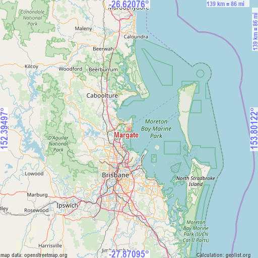
Margate GPS coordinates[2]
27° 14' 51.396" South, 153° 5' 53.124" East
| Map corner | latitude | longitude |
|---|---|---|
| Upper-left | -26.62076°, | 152.39497° |
| Center: | -27.24761°, | 153.09809° |
| Lower-right: | -27.87095°, | 153.80122° |
| Map W x H: | 139×139 km | = 86.4×86.4mi |
| max Lat: | -10.58257° ⇑15.1% North |
| Margate: | -27.24761° |
| min Lat: | ⇓84.9% South -43.31423° |
| min Long | Margate | max Long |
| 113.53327° | 153.09809° | 153.61246° |
| W 94.7%⇐ | ⇒5.3% E |
Elevation
Elevation of Margate is 16 m = 52 ft, and this is 106 m = 348 ft below average elevation for this country.
| Max E: |
1715 m = 5627 ft | 79% |
| Avg. | 122 m = 400 ft | |
| Margate | 16 m = 52 ft | |
Min E: |
-2 m = -7 ft | 21% |
See also: Australia elevation on elevation.city.
Geographical zone
Margate is located in South temperate zone (between Tropic of Capricorn and the Antarctic Circle). Distance of this Southern Tropic circle is 423.7 km =263.3 mi to North.| Distance of | km | miles | from Margate |
|---|---|---|---|
| Equator | 3029.7 | 1882.6 | to North |
| Tropic Capricorn | 423.7 | 263.3 | to North |
| Antarctic Circle | 4371.5 | 2716.3 | to South |
| South Pole | 6977.4 | 4335.6 | to South |


Nearby cities:
15 places around Margate: (largest is in red/bold)
• Brighton
6.7 km =4.2 mi,  217°
217°
• Clontarf
2.1 km =1.3 mi,  251°
251°
• Deagon
9.6 km =6 mi,  202°
202°
• Deception Bay
9.3 km =5.8 mi,  310°
310°
• Griffin
6.4 km =4 mi, 245°
• Kippa-Ring
2.8 km =1.7 mi,  329°
329°
• Mango Hill
7.4 km =4.6 mi,  273°
273°
• Murrumba Downs
8.9 km =5.5 mi,  255°
255°
• Newport
4.5 km =2.8 mi,  4°
4°
• North Lakes
8.1 km =5 mi,  288°
288°
• Rothwell
6.3 km =3.9 mi, 306°
• Sandgate
8.7 km =5.4 mi, 198°
• Scarborough
5.3 km =3.3 mi,  12°
12°
• Shorncliffe
9 km =5.6 mi,  190°
190°
• Woody Point
1.1 km =0.7 mi,  147°
147°
Sources, notices
• [Note1] Compared only with cities in Australia existing in our database
• [Src1] Map data: © OpenStreetMap contributors (CC-BY-SA)
• [Src2] Other city data from geonames.org with taken over terms of usage.
• [Src3] Geographical zone / Annual Mean Temperature by Robert A. Rohde @ Wikipedia
