Rothwell geodata
Rothwell (Queensland) is a section of populated place; located in Australia in Australia/Brisbane (GMT+10) time zone. With population of 7,100 people, there are 963 cities with bigger population in this country. Compared to other cities in Australia, 85.1% of cities are located further ↓South; 92.9% of cities are located further ←West and 90.1% of cities have higher elevation than Rothwell. Note1


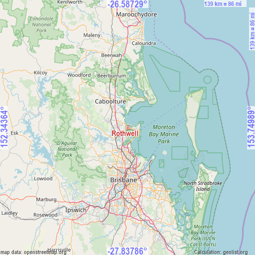
Rothwell GPS coordinates[2]
27° 12' 51.588" South, 153° 2' 48.336" East
| Map corner | latitude | longitude |
|---|---|---|
| Upper-left | -26.58729°, | 152.34364° |
| Center: | -27.21433°, | 153.04676° |
| Lower-right: | -27.83786°, | 153.74989° |
| Map W x H: | 139.1×139.1 km | = 86.4×86.4mi |
| max Lat: | -10.58257° ⇑14.9% North |
| Rothwell: | -27.21433° |
| min Lat: | ⇓85.1% South -43.31423° |
| min Long | Rothwell | max Long |
| 113.53327° | 153.04676° | 153.61246° |
| W 92.9%⇐ | ⇒7.1% E |
Elevation
Elevation of Rothwell is 9 m = 30 ft, and this is 113 m = 371 ft below average elevation for this country.
| Max E: |
1715 m = 5627 ft | 90.1% |
| Avg. | 122 m = 400 ft | |
| Rothwell | 9 m = 30 ft | |
Min E: |
-2 m = -7 ft | 9.9% |
See also: Australia elevation on elevation.city.
Geographical zone
Rothwell is located in South temperate zone (between Tropic of Capricorn and the Antarctic Circle). Distance of this Southern Tropic circle is 420 km =261 mi to North.| Distance of | km | miles | from Rothwell |
|---|---|---|---|
| Equator | 3025.9 | 1880.2 | to North |
| Tropic Capricorn | 420 | 261 | to North |
| Antarctic Circle | 4375.2 | 2718.6 | to South |
| South Pole | 6981.1 | 4337.9 | to South |


Nearby cities:
15 places around Rothwell: (largest is in red/bold)
• Clontarf
5.4 km =3.4 mi,  144°
144°
• Dakabin
5.7 km =3.5 mi,  256°
256°
• Deception Bay
3.1 km =1.9 mi,  318°
318°
• Griffin
6.4 km =4 mi,  186°
186°
• Kallangur
6.8 km =4.2 mi,  232°
232°
• Kippa-Ring
3.9 km =2.4 mi,  109°
109°
• Kurwongbah
7.3 km =4.5 mi,  253°
253°
• Mango Hill
4 km =2.5 mi,  214°
214°
• Margate
6.3 km =3.9 mi,  126°
126°
• Murrumba Downs
6.9 km =4.3 mi, 211°
• Newport
5.5 km =3.4 mi,  81°
81°
• North Lakes
2.8 km =1.7 mi, 246°
• Petrie
8.6 km =5.3 mi, 227°
• Scarborough
6.4 km =4 mi, 76°
• Woody Point
7.3 km =4.5 mi, 129°
Sources, notices
• [Note1] Compared only with cities in Australia existing in our database
• [Src1] Map data: © OpenStreetMap contributors (CC-BY-SA)
• [Src2] Other city data from geonames.org with taken over terms of usage.
• [Src3] Geographical zone / Annual Mean Temperature by Robert A. Rohde @ Wikipedia
