Glenbrook geodata
Glenbrook (New South Wales) is a populated place; located in Australia in Australia/Sydney (GMT+11) time zone. With population of 4,913 people, there are 1502 cities with bigger population in this country. Compared to other cities in Australia, 50.9% of cities are located further ↑North; 59.8% of cities are located further ←West and 80.6% of cities have lower elevation than Glenbrook. Note1


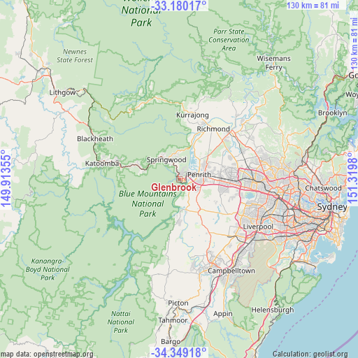
Glenbrook GPS coordinates[2]
33° 46' 0.012" South, 150° 37' 0.012" East
| Map corner | latitude | longitude |
|---|---|---|
| Upper-left | -33.18017°, | 149.91355° |
| Center: | -33.76667°, | 150.61667° |
| Lower-right: | -34.34918°, | 151.3198° |
| Map W x H: | 130×130 km | = 80.8×80.8mi |
| max Lat: | -10.58257° ⇑50.9% North |
| Glenbrook: | -33.76667° |
| min Lat: | ⇓49.1% South -43.31423° |
| min Long | Glenbrook | max Long |
| 113.53327° | 150.61667° | 153.61246° |
| W 59.8%⇐ | ⇒40.2% E |
Elevation
Elevation of Glenbrook is 187 m = 614 ft, and this is 65 m = 213 ft above average elevation for this country.
| Max E: |
1715 m = 5627 ft | 19.4% |
| Glenbrook | 187 m 614 ft | |
| Avg. | 122 m = 400 ft | |
Min E: |
-2 m = -7 ft | 80.6% |
See also: Australia elevation on elevation.city.
Geographical zone
Glenbrook is located in South temperate zone (between Tropic of Capricorn and the Antarctic Circle). Distance of this Southern Tropic circle is 1148.6 km =713.7 mi to North.| Distance of | km | miles | from Glenbrook |
|---|---|---|---|
| Equator | 3754.5 | 2332.9 | to North |
| Tropic Capricorn | 1148.6 | 713.7 | to North |
| Antarctic Circle | 3646.7 | 2266 | to South |
| South Pole | 6252.6 | 3885.2 | to South |


Nearby cities:
15 places around Glenbrook: (largest is in red/bold)
• Blaxland
2.4 km =1.5 mi,  320°
320°
• Emu Heights
4.6 km =2.9 mi,  39°
39°
• Emu Plains
5 km =3.1 mi,  68°
68°
• Glenmore Park
5.5 km =3.4 mi,  118°
118°
• Jamisontown
5.6 km =3.5 mi,  91°
91°
• Lapstone
1.9 km =1.2 mi, 115°
• Leonay
2.9 km =1.8 mi, 87°
• Mount Riverview
4.4 km =2.7 mi,  23°
23°
• Mulgoa
8.5 km =5.3 mi,  158°
158°
• Penrith
7.9 km =4.9 mi,  76°
76°
• Regentville
4.6 km =2.9 mi,  101°
101°
• South Penrith
7.2 km =4.5 mi, 96°
• Valley Heights
8 km =5 mi,  337°
337°
• Warrimoo
5.8 km =3.6 mi, 344°
• Yellow Rock
7.8 km =4.8 mi,  12°
12°
Sources, notices
• [Note1] Compared only with cities in Australia existing in our database
• [Src1] Map data: © OpenStreetMap contributors (CC-BY-SA)
• [Src2] Other city data from geonames.org with taken over terms of usage.
• [Src3] Geographical zone / Annual Mean Temperature by Robert A. Rohde @ Wikipedia
