Valley Heights geodata
Valley Heights (New South Wales) is a section of populated place; located in Australia in Australia/Sydney (GMT+11) time zone. With population of 1,207 people, there are 3573 cities with bigger population in this country. Compared to other cities in Australia, 51.3% of cities are located further ↓South; 59.4% of cities are located further ←West and 88.4% of cities have lower elevation than Valley Heights. Note1


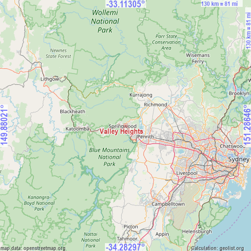
Valley Heights GPS coordinates[2]
33° 42' 0" South, 150° 34' 59.988" East
| Map corner | latitude | longitude |
|---|---|---|
| Upper-left | -33.11305°, | 149.88021° |
| Center: | -33.7°, | 150.58333° |
| Lower-right: | -34.28297°, | 151.28646° |
| Map W x H: | 130.1×130.1 km | = 80.8×80.8mi |
| max Lat: | -10.58257° ⇑48.7% North |
| Valley Heights: | -33.7° |
| min Lat: | ⇓51.3% South -43.31423° |
| min Long | Valley Heights | max Long |
| 113.53327° | 150.58333° | 153.61246° |
| W 59.4%⇐ | ⇒40.6% E |
Elevation
Elevation of Valley Heights is 323 m = 1060 ft, and this is 201 m = 659 ft above average elevation for this country.
| Max E: |
1715 m = 5627 ft | 11.6% |
| Valley Heights | 323 m 1060 ft | |
| Avg. | 122 m = 400 ft | |
Min E: |
-2 m = -7 ft | 88.4% |
See also: Australia elevation on elevation.city.
Geographical zone
Valley Heights is located in South temperate zone (between Tropic of Capricorn and the Antarctic Circle). Distance of this Southern Tropic circle is 1141.2 km =709.1 mi to North.| Distance of | km | miles | from Valley Heights |
|---|---|---|---|
| Equator | 3747.1 | 2328.3 | to North |
| Tropic Capricorn | 1141.2 | 709.1 | to North |
| Antarctic Circle | 3654.1 | 2270.6 | to South |
| South Pole | 6260 | 3889.8 | to South |


Nearby cities:
15 places around Valley Heights: (largest is in red/bold)
• Blaxland
5.8 km =3.6 mi,  164°
164°
• Castlereagh
8.9 km =5.5 mi,  82°
82°
• Emu Heights
7.2 km =4.5 mi,  122°
122°
• Emu Plains
9.5 km =5.9 mi,  125°
125°
• Faulconbridge
4.6 km =2.9 mi,  270°
270°
• Glenbrook
8 km =5 mi, 157°
• Lapstone
9.6 km =6 mi,  149°
149°
• Leonay
9.4 km =5.8 mi,  140°
140°
• Mount Riverview
5.9 km =3.7 mi, 125°
• Regentville
11.3 km =7 mi, 137°
• Springwood
3.1 km =1.9 mi, 270°
• Warrimoo
2.4 km =1.5 mi, 140°
• Winmalee
3.6 km =2.2 mi,  48°
48°
• Woodford
10 km =6.2 mi,  248°
248°
• Yellow Rock
4.7 km =2.9 mi,  87°
87°
Sources, notices
• [Note1] Compared only with cities in Australia existing in our database
• [Src1] Map data: © OpenStreetMap contributors (CC-BY-SA)
• [Src2] Other city data from geonames.org with taken over terms of usage.
• [Src3] Geographical zone / Annual Mean Temperature by Robert A. Rohde @ Wikipedia
