Epping geodata
Epping (Victoria) is a section of populated place; located in Australia in Australia/Melbourne (GMT+11) time zone. With population of 32,696 people, there are 57 cities with bigger population in this country. Compared to other cities in Australia, 83.9% of cities are located further ↑North; 65.8% of cities are located further →East and 74.9% of cities have lower elevation than Epping. Note1


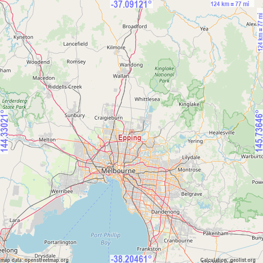
Epping GPS coordinates[2]
37° 39' 0" South, 145° 1' 59.988" East
| Map corner | latitude | longitude |
|---|---|---|
| Upper-left | -37.09121°, | 144.33021° |
| Center: | -37.65°, | 145.03333° |
| Lower-right: | -38.20461°, | 145.73646° |
| Map W x H: | 123.8×123.8 km | = 76.9×76.9mi |
| max Lat: | -10.58257° ⇑83.9% North |
| Epping: | -37.65° |
| min Lat: | ⇓16.1% South -43.31423° |
| min Long | Epping | max Long |
| 113.53327° | 145.03333° | 153.61246° |
| W 34.2%⇐ | ⇒65.8% E |
Elevation
Elevation of Epping is 131 m = 430 ft, and this is 9 m = 30 ft above average elevation for this country.
| Max E: |
1715 m = 5627 ft | 25.1% |
| Epping | 131 m 430 ft | |
| Avg. | 122 m = 400 ft | |
Min E: |
-2 m = -7 ft | 74.9% |
See also: Australia elevation on elevation.city.
Geographical zone
Epping is located in South temperate zone (between Tropic of Capricorn and the Antarctic Circle). Distance of this Southern Tropic circle is 1580.4 km =982 mi to North.| Distance of | km | miles | from Epping |
|---|---|---|---|
| Equator | 4186.3 | 2601.2 | to North |
| Tropic Capricorn | 1580.4 | 982 | to North |
| Antarctic Circle | 3214.9 | 1997.6 | to South |
| South Pole | 5820.8 | 3616.9 | to South |


Nearby cities:
15 places around Epping: (largest is in red/bold)
• Bundoora
5.8 km =3.6 mi,  156°
156°
• Campbellfield
6.7 km =4.2 mi,  256°
256°
• Coolaroo
8.7 km =5.4 mi,  265°
265°
• Greensborough
8.6 km =5.3 mi,  134°
134°
• Kingsbury
7.1 km =4.4 mi,  178°
178°
• Lalor
2.4 km =1.5 mi,  218°
218°
• Mernda
7.7 km =4.8 mi,  45°
45°
• Mill Park
3.5 km =2.2 mi,  122°
122°
• Plenty
7.6 km =4.7 mi,  104°
104°
• Reservoir
8 km =5 mi,  201°
201°
• South Morang
5.9 km =3.7 mi,  90°
90°
• Thomastown
4 km =2.5 mi, 201°
• Watsonia
8.6 km =5.3 mi,  149°
149°
• Watsonia North
7.1 km =4.4 mi,  140°
140°
• Wollert
7.4 km =4.6 mi,  0°
0°
Sources, notices
• [Note1] Compared only with cities in Australia existing in our database
• [Src1] Map data: © OpenStreetMap contributors (CC-BY-SA)
• [Src2] Other city data from geonames.org with taken over terms of usage.
• [Src3] Geographical zone / Annual Mean Temperature by Robert A. Rohde @ Wikipedia
