Coledale geodata
Coledale (New South Wales) is a section of populated place; located in Australia in Australia/Sydney (GMT+11) time zone. With population of 1,233 people, there are 3540 cities with bigger population in this country. Compared to other cities in Australia, 61.8% of cities are located further ↑North; 66.5% of cities are located further ←West and 73.6% of cities have higher elevation than Coledale. Note1


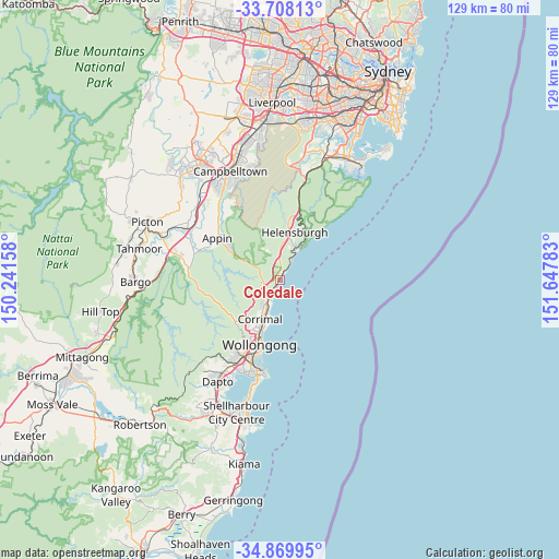
Coledale GPS coordinates[2]
34° 17' 27.78" South, 150° 56' 40.92" East
| Map corner | latitude | longitude |
|---|---|---|
| Upper-left | -33.70813°, | 150.24158° |
| Center: | -34.29105°, | 150.9447° |
| Lower-right: | -34.86995°, | 151.64783° |
| Map W x H: | 129.2×129.2 km | = 80.3×80.3mi |
| max Lat: | -10.58257° ⇑61.8% North |
| Coledale: | -34.29105° |
| min Lat: | ⇓38.2% South -43.31423° |
| min Long | Coledale | max Long |
| 113.53327° | 150.9447° | 153.61246° |
| W 66.5%⇐ | ⇒33.5% E |
Elevation
Elevation of Coledale is 20 m = 66 ft, and this is 102 m = 335 ft below average elevation for this country.
| Max E: |
1715 m = 5627 ft | 73.6% |
| Avg. | 122 m = 400 ft | |
| Coledale | 20 m = 66 ft | |
Min E: |
-2 m = -7 ft | 26.4% |
See also: Australia elevation on elevation.city.
Geographical zone
Coledale is located in South temperate zone (between Tropic of Capricorn and the Antarctic Circle). Distance of this Southern Tropic circle is 1206.9 km =749.9 mi to North.| Distance of | km | miles | from Coledale |
|---|---|---|---|
| Equator | 3812.8 | 2369.2 | to North |
| Tropic Capricorn | 1206.9 | 749.9 | to North |
| Antarctic Circle | 3588.4 | 2229.7 | to South |
| South Pole | 6194.3 | 3849 | to South |


Nearby cities:
15 places around Coledale: (largest is in red/bold)
• Austinmer
1.9 km =1.2 mi,  213°
213°
• Bellambi
8.8 km =5.5 mi,  197°
197°
• Bulli
6 km =3.7 mi, 208°
• Corrimal
10.4 km =6.5 mi, 201°
• East Corrimal
10 km =6.2 mi, 198°
• Fairy Meadow
12.3 km =7.6 mi, 202°
• Fern Hill
11.6 km =7.2 mi, 207°
• Russell Vale
8.5 km =5.3 mi, 212°
• Stanwell Park
8.2 km =5.1 mi,  27°
27°
• Stanwell Tops
8.5 km =5.3 mi,  20°
20°
• Tarrawanna
11.3 km =7 mi, 207°
• Thirroul
3.5 km =2.2 mi,  217°
217°
• Towradgi
11.3 km =7 mi, 199°
• Wombarra
1 km =0.6 mi, 29°
• Woonona
7.1 km =4.4 mi, 203°
Sources, notices
• [Note1] Compared only with cities in Australia existing in our database
• [Src1] Map data: © OpenStreetMap contributors (CC-BY-SA)
• [Src2] Other city data from geonames.org with taken over terms of usage.
• [Src3] Geographical zone / Annual Mean Temperature by Robert A. Rohde @ Wikipedia
