Stanwell Tops geodata
Stanwell Tops (New South Wales) is a section of populated place; located in Australia in Australia/Sydney (GMT+11) time zone. With population of 514 people, there are 4837 cities with bigger population in this country. Compared to other cities in Australia, 61.3% of cities are located further ↑North; 67.1% of cities are located further ←West and 86.1% of cities have lower elevation than Stanwell Tops. Note1


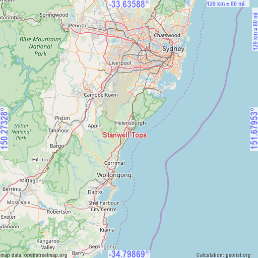
Stanwell Tops GPS coordinates[2]
34° 13' 9.444" South, 150° 58' 35.04" East
| Map corner | latitude | longitude |
|---|---|---|
| Upper-left | -33.63588°, | 150.27328° |
| Center: | -34.21929°, | 150.9764° |
| Lower-right: | -34.79869°, | 151.67953° |
| Map W x H: | 129.3×129.3 km | = 80.3×80.3mi |
| max Lat: | -10.58257° ⇑61.3% North |
| Stanwell Tops: | -34.21929° |
| min Lat: | ⇓38.7% South -43.31423° |
| min Long | Stanwell Tops | max Long |
| 113.53327° | 150.9764° | 153.61246° |
| W 67.1%⇐ | ⇒32.9% E |
Elevation
Elevation of Stanwell Tops is 269 m = 883 ft, and this is 147 m = 482 ft above average elevation for this country.
| Max E: |
1715 m = 5627 ft | 13.9% |
| Stanwell Tops | 269 m 883 ft | |
| Avg. | 122 m = 400 ft | |
Min E: |
-2 m = -7 ft | 86.1% |
See also: Australia elevation on elevation.city.
Geographical zone
Stanwell Tops is located in South temperate zone (between Tropic of Capricorn and the Antarctic Circle). Distance of this Southern Tropic circle is 1198.9 km =745 mi to North.| Distance of | km | miles | from Stanwell Tops |
|---|---|---|---|
| Equator | 3804.8 | 2364.2 | to North |
| Tropic Capricorn | 1198.9 | 745 | to North |
| Antarctic Circle | 3596.3 | 2234.6 | to South |
| South Pole | 6202.2 | 3853.9 | to South |


Nearby cities:
15 places around Stanwell Tops: (largest is in red/bold)
• Appin
17.6 km =10.9 mi,  275°
275°
• Austinmer
10.3 km =6.4 mi,  202°
202°
• Bellambi
17.3 km =10.7 mi, 198°
• Bulli
14.4 km =8.9 mi, 203°
• Coledale
8.5 km =5.3 mi, 200°
• East Corrimal
18.4 km =11.4 mi, 199°
• Engadine
17.4 km =10.8 mi,  11°
11°
• Heathcote
15.4 km =9.6 mi, 12°
• Helensburgh
4.9 km =3 mi,  20°
20°
• Russell Vale
16.9 km =10.5 mi,  206°
206°
• Stanwell Park
1.2 km =0.7 mi,  131°
131°
• Thirroul
11.9 km =7.4 mi, 205°
• Wedderburn
17.5 km =10.9 mi,  303°
303°
• Wombarra
7.5 km =4.7 mi, 198°
• Woonona
15.5 km =9.6 mi, 201°
Sources, notices
• [Note1] Compared only with cities in Australia existing in our database
• [Src1] Map data: © OpenStreetMap contributors (CC-BY-SA)
• [Src2] Other city data from geonames.org with taken over terms of usage.
• [Src3] Geographical zone / Annual Mean Temperature by Robert A. Rohde @ Wikipedia
