Caulfield geodata
Caulfield (Victoria) is a populated place; located in Australia in Australia/Melbourne (GMT+11) time zone. With population of 5,731 people, there are 1279 cities with bigger population in this country. Compared to other cities in Australia, 89.9% of cities are located further ↑North; 65.9% of cities are located further →East and 56.9% of cities have higher elevation than Caulfield. Note1


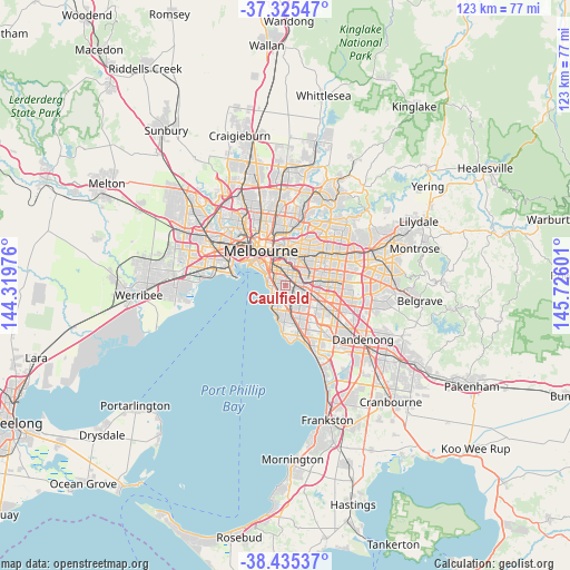
Caulfield GPS coordinates[2]
37° 52' 57.036" South, 145° 1' 22.368" East
| Map corner | latitude | longitude |
|---|---|---|
| Upper-left | -37.32547°, | 144.31976° |
| Center: | -37.88251°, | 145.02288° |
| Lower-right: | -38.43537°, | 145.72601° |
| Map W x H: | 123.4×123.4 km | = 76.7×76.7mi |
| max Lat: | -10.58257° ⇑89.9% North |
| Caulfield: | -37.88251° |
| min Lat: | ⇓10.1% South -43.31423° |
| min Long | Caulfield | max Long |
| 113.53327° | 145.02288° | 153.61246° |
| W 34.1%⇐ | ⇒65.9% E |
Elevation
Elevation of Caulfield is 36 m = 118 ft, and this is 86 m = 282 ft below average elevation for this country.
| Max E: |
1715 m = 5627 ft | 56.9% |
| Avg. | 122 m = 400 ft | |
| Caulfield | 36 m = 118 ft | |
Min E: |
-2 m = -7 ft | 43.1% |
See also: Australia elevation on elevation.city.
Geographical zone
Caulfield is located in South temperate zone (between Tropic of Capricorn and the Antarctic Circle). Distance of this Southern Tropic circle is 1606.2 km =998 mi to North.| Distance of | km | miles | from Caulfield |
|---|---|---|---|
| Equator | 4212.1 | 2617.3 | to North |
| Tropic Capricorn | 1606.2 | 998 | to North |
| Antarctic Circle | 3189 | 1981.6 | to South |
| South Pole | 5794.9 | 3600.8 | to South |


Nearby cities:
15 places around Caulfield: (largest is in red/bold)
• Armadale
3 km =1.9 mi,  356°
356°
• Balaclava
2.7 km =1.7 mi,  311°
311°
• Brighton East
2.3 km =1.4 mi,  192°
192°
• Carnegie
3.1 km =1.9 mi,  113°
113°
• Caulfield East
1.7 km =1.1 mi,  85°
85°
• Caulfield North
1 km =0.6 mi,  10°
10°
• Caulfield South
1.5 km =0.9 mi,  169°
169°
• Elsternwick
1.8 km =1.1 mi,  256°
256°
• Gardenvale
2.1 km =1.3 mi,  214°
214°
• Glen Huntly
2 km =1.2 mi,  124°
124°
• Malvern
2.3 km =1.4 mi, 11°
• Malvern East
2 km =1.2 mi,  61°
61°
• Ormond
2.2 km =1.4 mi,  154°
154°
• Ripponlea
2 km =1.2 mi,  267°
267°
• St Kilda East
2.7 km =1.7 mi, 312°
Sources, notices
• [Note1] Compared only with cities in Australia existing in our database
• [Src1] Map data: © OpenStreetMap contributors (CC-BY-SA)
• [Src2] Other city data from geonames.org with taken over terms of usage.
• [Src3] Geographical zone / Annual Mean Temperature by Robert A. Rohde @ Wikipedia
