Yorkeys Knob geodata
Yorkeys Knob (Queensland) is a section of populated place; located in Australia in Australia/Brisbane (GMT+10) time zone. With population of 2,879 people, there are 2328 cities with bigger population in this country. Compared to other cities in Australia, 97.6% of cities are located further ↓South; 58.5% of cities are located further →East and 55.2% of cities have higher elevation than Yorkeys Knob. Note1


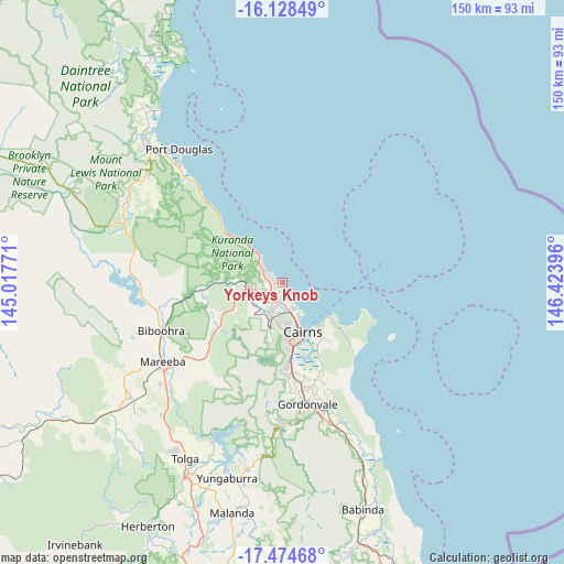
Yorkeys Knob GPS coordinates[2]
16° 48' 10.008" South, 145° 43' 14.988" East
| Map corner | latitude | longitude |
|---|---|---|
| Upper-left | -16.12849°, | 145.01771° |
| Center: | -16.80278°, | 145.72083° |
| Lower-right: | -17.47468°, | 146.42396° |
| Map W x H: | 149.7×149.7 km | = 93×93mi |
| max Lat: | -10.58257° ⇑2.4% North |
| Yorkeys Knob: | -16.80278° |
| min Lat: | ⇓97.6% South -43.31423° |
| min Long | Yorkeys Knob | max Long |
| 113.53327° | 145.72083° | 153.61246° |
| W 41.5%⇐ | ⇒58.5% E |
Elevation
Elevation of Yorkeys Knob is 38 m = 125 ft, and this is 84 m = 276 ft below average elevation for this country.
| Max E: |
1715 m = 5627 ft | 55.2% |
| Avg. | 122 m = 400 ft | |
| Yorkeys Knob | 38 m = 125 ft | |
Min E: |
-2 m = -7 ft | 44.8% |
See also: Australia elevation on elevation.city.
Geographical zone
Yorkeys Knob is located in South Torrid zone (between Equator and Tropic of Capricorn). Distance of this Southern Tropic circle is 737.6 km =458.3 mi to South.| Distance of | km | miles | from Yorkeys Knob |
|---|---|---|---|
| Equator | 1868.3 | 1160.9 | to North |
| Tropic Capricorn | 737.6 | 458.3 | to South |
| Antarctic Circle | 5532.9 | 3438 | to South |
| South Pole | 8138.8 | 5057.2 | to South |


Nearby cities:
15 places around Yorkeys Knob: (largest is in red/bold)
• Brinsmead
10.7 km =6.6 mi,  183°
183°
• Cairns North
11.9 km =7.4 mi,  161°
161°
• Caravonica
8.7 km =5.4 mi,  209°
209°
• Clifton Beach
6.8 km =4.2 mi,  310°
310°
• Edge Hill
11.2 km =7 mi, 163°
• Freshwater
9 km =5.6 mi, 182°
• Holloways Beach
4.8 km =3 mi, 155°
• Kamerunga
8.1 km =5 mi,  194°
194°
• Kewarra Beach
4.5 km =2.8 mi,  300°
300°
• Kuranda
9 km =5.6 mi,  257°
257°
• Machans Beach
6.7 km =4.2 mi, 157°
• Palm Cove
8.2 km =5.1 mi,  315°
315°
• Trinity Beach
3 km =1.9 mi, 301°
• Trinity Park
1.7 km =1.1 mi,  254°
254°
• Whitfield
10.3 km =6.4 mi,  172°
172°
Sources, notices
• [Note1] Compared only with cities in Australia existing in our database
• [Src1] Map data: © OpenStreetMap contributors (CC-BY-SA)
• [Src2] Other city data from geonames.org with taken over terms of usage.
• [Src3] Geographical zone / Annual Mean Temperature by Robert A. Rohde @ Wikipedia
