Helensburgh geodata
Helensburgh (New South Wales) is a section of populated place; located in Australia in Australia/Sydney (GMT+11) time zone. With population of 6,221 people, there are 1145 cities with bigger population in this country. Compared to other cities in Australia, 61.1% of cities are located further ↑North; 67.4% of cities are located further ←West and 78.9% of cities have lower elevation than Helensburgh. Note1


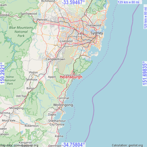
Helensburgh GPS coordinates[2]
34° 10' 42.096" South, 150° 59' 42.792" East
| Map corner | latitude | longitude |
|---|---|---|
| Upper-left | -33.59467°, | 150.2921° |
| Center: | -34.17836°, | 150.99522° |
| Lower-right: | -34.75804°, | 151.69835° |
| Map W x H: | 129.4×129.4 km | = 80.4×80.4mi |
| max Lat: | -10.58257° ⇑61.1% North |
| Helensburgh: | -34.17836° |
| min Lat: | ⇓38.9% South -43.31423° |
| min Long | Helensburgh | max Long |
| 113.53327° | 150.99522° | 153.61246° |
| W 67.4%⇐ | ⇒32.6% E |
Elevation
Elevation of Helensburgh is 167 m = 548 ft, and this is 45 m = 148 ft above average elevation for this country.
| Max E: |
1715 m = 5627 ft | 21.1% |
| Helensburgh | 167 m 548 ft | |
| Avg. | 122 m = 400 ft | |
Min E: |
-2 m = -7 ft | 78.9% |
See also: Australia elevation on elevation.city.
Geographical zone
Helensburgh is located in South temperate zone (between Tropic of Capricorn and the Antarctic Circle). Distance of this Southern Tropic circle is 1194.4 km =742.2 mi to North.| Distance of | km | miles | from Helensburgh |
|---|---|---|---|
| Equator | 3800.3 | 2361.4 | to North |
| Tropic Capricorn | 1194.4 | 742.2 | to North |
| Antarctic Circle | 3600.9 | 2237.5 | to South |
| South Pole | 6206.8 | 3856.7 | to South |


Nearby cities:
15 places around Helensburgh: (largest is in red/bold)
• Austinmer
15.2 km =9.4 mi,  201°
201°
• Barden Ridge
16.1 km =10 mi,  5°
5°
• Coledale
13.4 km =8.3 mi, 200°
• Engadine
12.6 km =7.8 mi, 7°
• Grays Point
15.7 km =9.8 mi,  32°
32°
• Gymea Bay
16.4 km =10.2 mi, 31°
• Heathcote
10.6 km =6.6 mi, 8°
• Lilli Pilli
16.5 km =10.3 mi,  42°
42°
• Loftus
15.6 km =9.7 mi,  17°
17°
• Stanwell Park
5.4 km =3.4 mi,  189°
189°
• Stanwell Tops
4.9 km =3 mi, 200°
• Thirroul
16.7 km =10.4 mi, 203°
• Wombarra
12.4 km =7.7 mi, 199°
• Woronora Heights
16.1 km =10 mi, 10°
• Yarrawarrah
14.4 km =8.9 mi, 15°
Sources, notices
• [Note1] Compared only with cities in Australia existing in our database
• [Src1] Map data: © OpenStreetMap contributors (CC-BY-SA)
• [Src2] Other city data from geonames.org with taken over terms of usage.
• [Src3] Geographical zone / Annual Mean Temperature by Robert A. Rohde @ Wikipedia
