Balwyn North geodata
Balwyn North (Victoria) is a populated place; located in Australia in Australia/Melbourne (GMT+11) time zone. With population of 20,015 people, there are 166 cities with bigger population in this country. Compared to other cities in Australia, 87.2% of cities are located further ↑North; 64.6% of cities are located further →East and 58% of cities have lower elevation than Balwyn North. Note1


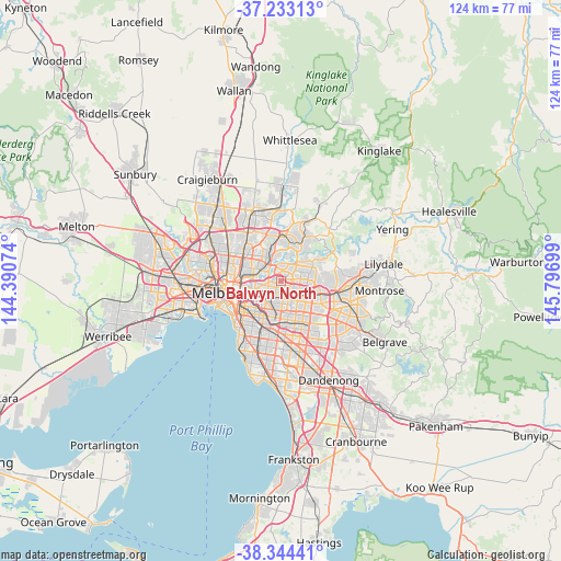
Balwyn North GPS coordinates[2]
37° 47' 27.096" South, 145° 5' 37.896" East
| Map corner | latitude | longitude |
|---|---|---|
| Upper-left | -37.23313°, | 144.39074° |
| Center: | -37.79086°, | 145.09386° |
| Lower-right: | -38.34441°, | 145.79699° |
| Map W x H: | 123.6×123.6 km | = 76.8×76.8mi |
| max Lat: | -10.58257° ⇑87.2% North |
| Balwyn North: | -37.79086° |
| min Lat: | ⇓12.8% South -43.31423° |
| min Long | Balwyn North | max Long |
| 113.53327° | 145.09386° | 153.61246° |
| W 35.4%⇐ | ⇒64.6% E |
Elevation
Elevation of Balwyn North is 59 m = 194 ft, and this is 63 m = 207 ft below average elevation for this country.
| Max E: |
1715 m = 5627 ft | 42% |
| Avg. | 122 m = 400 ft | |
| Balwyn North | 59 m = 194 ft | |
Min E: |
-2 m = -7 ft | 58% |
See also: Australia elevation on elevation.city.
Geographical zone
Balwyn North is located in South temperate zone (between Tropic of Capricorn and the Antarctic Circle). Distance of this Southern Tropic circle is 1596 km =991.7 mi to North.| Distance of | km | miles | from Balwyn North |
|---|---|---|---|
| Equator | 4201.9 | 2610.9 | to North |
| Tropic Capricorn | 1596 | 991.7 | to North |
| Antarctic Circle | 3199.2 | 1987.9 | to South |
| South Pole | 5805.1 | 3607.1 | to South |


Nearby cities:
15 places around Balwyn North: (largest is in red/bold)
• Balwyn
2.4 km =1.5 mi,  212°
212°
• Box Hill
4.2 km =2.6 mi,  138°
138°
• Box Hill North
3.2 km =2 mi,  114°
114°
• Bulleen
2.8 km =1.7 mi,  341°
341°
• Canterbury
3.8 km =2.4 mi,  191°
191°
• Doncaster
2.6 km =1.6 mi,  83°
83°
• Doncaster East
4.8 km =3 mi,  85°
85°
• Eaglemont
4 km =2.5 mi,  318°
318°
• Ivanhoe
5.1 km =3.2 mi,  298°
298°
• Ivanhoe East
3.4 km =2.1 mi, 304°
• Kew East
3.6 km =2.2 mi,  258°
258°
• Mont Albert
3.3 km =2.1 mi,  157°
157°
• Mont Albert North
1.7 km =1.1 mi,  130°
130°
• Surrey Hills
2.9 km =1.8 mi,  169°
169°
• Templestowe Lower
3.4 km =2.1 mi,  36°
36°
Sources, notices
• [Note1] Compared only with cities in Australia existing in our database
• [Src1] Map data: © OpenStreetMap contributors (CC-BY-SA)
• [Src2] Other city data from geonames.org with taken over terms of usage.
• [Src3] Geographical zone / Annual Mean Temperature by Robert A. Rohde @ Wikipedia
