Blackstone geodata
Blackstone (Queensland) is a section of populated place; located in Australia in Australia/Brisbane (GMT+10) time zone. With population of 999 people, there are 3819 cities with bigger population in this country. Compared to other cities in Australia, 78.8% of cities are located further ↓South; 87.1% of cities are located further ←West and 51.1% of cities have higher elevation than Blackstone. Note1


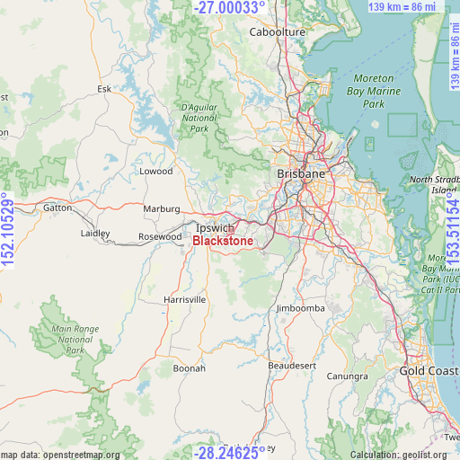
Blackstone GPS coordinates[2]
27° 37' 30.216" South, 152° 48' 30.276" East
| Map corner | latitude | longitude |
|---|---|---|
| Upper-left | -27.00033°, | 152.10529° |
| Center: | -27.62506°, | 152.80841° |
| Lower-right: | -28.24625°, | 153.51154° |
| Map W x H: | 138.5×138.5 km | = 86.1×86.1mi |
| max Lat: | -10.58257° ⇑21.2% North |
| Blackstone: | -27.62506° |
| min Lat: | ⇓78.8% South -43.31423° |
| min Long | Blackstone | max Long |
| 113.53327° | 152.80841° | 153.61246° |
| W 87.1%⇐ | ⇒12.9% E |
Elevation
Elevation of Blackstone is 44 m = 144 ft, and this is 78 m = 256 ft below average elevation for this country.
| Max E: |
1715 m = 5627 ft | 51.1% |
| Avg. | 122 m = 400 ft | |
| Blackstone | 44 m = 144 ft | |
Min E: |
-2 m = -7 ft | 48.9% |
See also: Australia elevation on elevation.city.
Geographical zone
Blackstone is located in South temperate zone (between Tropic of Capricorn and the Antarctic Circle). Distance of this Southern Tropic circle is 465.7 km =289.4 mi to North.| Distance of | km | miles | from Blackstone |
|---|---|---|---|
| Equator | 3071.6 | 1908.6 | to North |
| Tropic Capricorn | 465.7 | 289.4 | to North |
| Antarctic Circle | 4329.6 | 2690.3 | to South |
| South Pole | 6935.4 | 4309.5 | to South |


Nearby cities:
15 places around Blackstone: (largest is in red/bold)
• Basin Pocket
4.6 km =2.9 mi,  307°
307°
• Booval
2.3 km =1.4 mi, 305°
• Bundamba
1.8 km =1.1 mi,  9°
9°
• Dinmore
3.7 km =2.3 mi,  41°
41°
• East Ipswich
4.1 km =2.5 mi,  300°
300°
• Eastern Heights
3 km =1.9 mi,  262°
262°
• Flinders View
4.4 km =2.7 mi,  229°
229°
• Ipswich
4.7 km =2.9 mi,  272°
272°
• Moores Pocket
4.3 km =2.7 mi, 314°
• Newtown
3.3 km =2.1 mi,  287°
287°
• North Booval
2.7 km =1.7 mi,  330°
330°
• North Ipswich
5.2 km =3.2 mi, 298°
• Raceview
3.4 km =2.1 mi,  251°
251°
• Riverview
5 km =3.1 mi,  55°
55°
• Silkstone
2.1 km =1.3 mi,  281°
281°
Sources, notices
• [Note1] Compared only with cities in Australia existing in our database
• [Src1] Map data: © OpenStreetMap contributors (CC-BY-SA)
• [Src2] Other city data from geonames.org with taken over terms of usage.
• [Src3] Geographical zone / Annual Mean Temperature by Robert A. Rohde @ Wikipedia
