Grasmere geodata
Grasmere (New South Wales) is a section of populated place; located in Australia in Australia/Sydney (GMT+11) time zone. With population of 1,922 people, there are 2958 cities with bigger population in this country. Compared to other cities in Australia, 60.1% of cities are located further ↑North; 60.3% of cities are located further ←West and 67.8% of cities have lower elevation than Grasmere. Note1


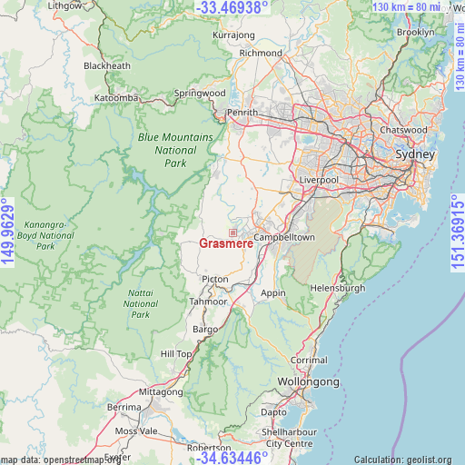
Grasmere GPS coordinates[2]
34° 3' 14.112" South, 150° 39' 57.672" East
| Map corner | latitude | longitude |
|---|---|---|
| Upper-left | -33.46938°, | 149.9629° |
| Center: | -34.05392°, | 150.66602° |
| Lower-right: | -34.63446°, | 151.36915° |
| Map W x H: | 129.5×129.5 km | = 80.5×80.5mi |
| max Lat: | -10.58257° ⇑60.1% North |
| Grasmere: | -34.05392° |
| min Lat: | ⇓39.9% South -43.31423° |
| min Long | Grasmere | max Long |
| 113.53327° | 150.66602° | 153.61246° |
| W 60.3%⇐ | ⇒39.7% E |
Elevation
Elevation of Grasmere is 92 m = 302 ft, and this is 30 m = 98 ft below average elevation for this country.
| Max E: |
1715 m = 5627 ft | 32.2% |
| Avg. | 122 m = 400 ft | |
| Grasmere | 92 m = 302 ft | |
Min E: |
-2 m = -7 ft | 67.8% |
See also: Australia elevation on elevation.city.
Geographical zone
Grasmere is located in South temperate zone (between Tropic of Capricorn and the Antarctic Circle). Distance of this Southern Tropic circle is 1180.5 km =733.5 mi to North.| Distance of | km | miles | from Grasmere |
|---|---|---|---|
| Equator | 3786.4 | 2352.8 | to North |
| Tropic Capricorn | 1180.5 | 733.5 | to North |
| Antarctic Circle | 3614.7 | 2246.1 | to South |
| South Pole | 6220.6 | 3865.3 | to South |


Nearby cities:
15 places around Grasmere: (largest is in red/bold)
• Camden
2.8 km =1.7 mi,  90°
90°
• Camden South
4.2 km =2.6 mi,  140°
140°
• Cobbitty
4.4 km =2.7 mi,  15°
15°
• Elderslie
4.4 km =2.7 mi, 91°
• Ellis Lane
2.6 km =1.6 mi,  25°
25°
• Harrington Park
7.2 km =4.5 mi,  62°
62°
• Kirkham
4.5 km =2.8 mi,  67°
67°
• Mount Annan
8.6 km =5.3 mi, 89°
• Mount Hunter
3.3 km =2.1 mi,  232°
232°
• Narellan
6.2 km =3.9 mi,  79°
79°
• Narellan Vale
7.2 km =4.5 mi, 86°
• Oran Park
8.7 km =5.4 mi,  51°
51°
• Orangeville
6.4 km =4 mi,  293°
293°
• Spring Farm
4.5 km =2.8 mi,  111°
111°
• Theresa Park
6 km =3.7 mi,  331°
331°
Sources, notices
• [Note1] Compared only with cities in Australia existing in our database
• [Src1] Map data: © OpenStreetMap contributors (CC-BY-SA)
• [Src2] Other city data from geonames.org with taken over terms of usage.
• [Src3] Geographical zone / Annual Mean Temperature by Robert A. Rohde @ Wikipedia
