Leschenault geodata
Leschenault (Western Australia) is a section of populated place; located in Australia in Australia/Perth (GMT+8) time zone. With population of 2,772 people, there are 2398 cities with bigger population in this country. Compared to other cities in Australia, 55.9% of cities are located further ↓South; 98% of cities are located further →East and 81.9% of cities have higher elevation than Leschenault. Note1


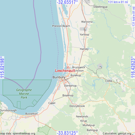
Leschenault GPS coordinates[2]
33° 14' 42.684" South, 115° 43' 30.36" East
| Map corner | latitude | longitude |
|---|---|---|
| Upper-left | -32.65517°, | 115.02198° |
| Center: | -33.24519°, | 115.7251° |
| Lower-right: | -33.83125°, | 116.42823° |
| Map W x H: | 130.8×130.8 km | = 81.3×81.3mi |
| max Lat: | -10.58257° ⇑44.1% North |
| Leschenault: | -33.24519° |
| min Lat: | ⇓55.9% South -43.31423° |
| min Long | Leschenault | max Long |
| 113.53327° | 115.7251° | 153.61246° |
| W 2%⇐ | ⇒98% E |
Elevation
Elevation of Leschenault is 14 m = 46 ft, and this is 108 m = 354 ft below average elevation for this country.
| Max E: |
1715 m = 5627 ft | 81.9% |
| Avg. | 122 m = 400 ft | |
| Leschenault | 14 m = 46 ft | |
Min E: |
-2 m = -7 ft | 18.1% |
See also: Australia elevation on elevation.city.
Geographical zone
Leschenault is located in South temperate zone (between Tropic of Capricorn and the Antarctic Circle). Distance of this Southern Tropic circle is 1090.6 km =677.7 mi to North.| Distance of | km | miles | from Leschenault |
|---|---|---|---|
| Equator | 3696.5 | 2296.9 | to North |
| Tropic Capricorn | 1090.6 | 677.7 | to North |
| Antarctic Circle | 3704.7 | 2302 | to South |
| South Pole | 6310.5 | 3921.2 | to South |


Nearby cities:
15 places around Leschenault: (largest is in red/bold)
• Australind
3.9 km =2.4 mi,  193°
193°
• Binningup
11.1 km =6.9 mi,  345°
345°
• Brunswick
12.9 km =8 mi,  83°
83°
• Bunbury
12 km =7.5 mi,  220°
220°
• Burekup
10.7 km =6.6 mi,  129°
129°
• Carey Park
13.5 km =8.4 mi,  211°
211°
• College Grove
15.8 km =9.8 mi,  202°
202°
• Dardanup West
15.7 km =9.8 mi,  178°
178°
• East Bunbury
11.8 km =7.3 mi, 210°
• Eaton
8.2 km =5.1 mi, 193°
• Glen Iris
11.3 km =7 mi, 204°
• Millbridge
6.8 km =4.2 mi,  172°
172°
• Pelican Point
8.7 km =5.4 mi, 200°
• Roelands
9.5 km =5.9 mi,  116°
116°
• South Bunbury
14.3 km =8.9 mi, 216°
Sources, notices
• [Note1] Compared only with cities in Australia existing in our database
• [Src1] Map data: © OpenStreetMap contributors (CC-BY-SA)
• [Src2] Other city data from geonames.org with taken over terms of usage.
• [Src3] Geographical zone / Annual Mean Temperature by Robert A. Rohde @ Wikipedia
