Eaton geodata
Eaton (Western Australia) is a section of populated place; located in Australia in Australia/Perth (GMT+8) time zone. With population of 8,166 people, there are 809 cities with bigger population in this country. Compared to other cities in Australia, 55.3% of cities are located further ↓South; 98.2% of cities are located further →East and 90.1% of cities have higher elevation than Eaton. Note1


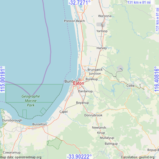
Eaton GPS coordinates[2]
33° 18' 59.904" South, 115° 42' 18.108" East
| Map corner | latitude | longitude |
|---|---|---|
| Upper-left | -32.7271°, | 115.00191° |
| Center: | -33.31664°, | 115.70503° |
| Lower-right: | -33.90222°, | 116.40816° |
| Map W x H: | 130.7×130.7 km | = 81.2×81.2mi |
| max Lat: | -10.58257° ⇑44.7% North |
| Eaton: | -33.31664° |
| min Lat: | ⇓55.3% South -43.31423° |
| min Long | Eaton | max Long |
| 113.53327° | 115.70503° | 153.61246° |
| W 1.8%⇐ | ⇒98.2% E |
Elevation
Elevation of Eaton is 9 m = 30 ft, and this is 113 m = 371 ft below average elevation for this country.
| Max E: |
1715 m = 5627 ft | 90.1% |
| Avg. | 122 m = 400 ft | |
| Eaton | 9 m = 30 ft | |
Min E: |
-2 m = -7 ft | 9.9% |
See also: Australia elevation on elevation.city.
Geographical zone
Eaton is located in South temperate zone (between Tropic of Capricorn and the Antarctic Circle). Distance of this Southern Tropic circle is 1098.5 km =682.6 mi to North.| Distance of | km | miles | from Eaton |
|---|---|---|---|
| Equator | 3704.5 | 2301.9 | to North |
| Tropic Capricorn | 1098.5 | 682.6 | to North |
| Antarctic Circle | 3696.7 | 2297 | to South |
| South Pole | 6302.6 | 3916.3 | to South |


Nearby cities:
15 places around Eaton: (largest is in red/bold)
• Australind
4.3 km =2.7 mi,  12°
12°
• Bunbury
6 km =3.7 mi,  258°
258°
• Burekup
10.2 km =6.3 mi,  83°
83°
• Carey Park
6.3 km =3.9 mi,  235°
235°
• College Grove
7.8 km =4.8 mi,  212°
212°
• Dardanup West
8.1 km =5 mi,  163°
163°
• East Bunbury
4.7 km =2.9 mi, 242°
• Glen Iris
3.7 km =2.3 mi,  231°
231°
• Leschenault
8.2 km =5.1 mi, 13°
• Millbridge
3 km =1.9 mi,  67°
67°
• Pelican Point
1.1 km =0.7 mi, 260°
• Roelands
11 km =6.8 mi, 70°
• South Bunbury
7.6 km =4.7 mi, 241°
• Usher
9.9 km =6.2 mi, 225°
• Withers
9 km =5.6 mi, 230°
Sources, notices
• [Note1] Compared only with cities in Australia existing in our database
• [Src1] Map data: © OpenStreetMap contributors (CC-BY-SA)
• [Src2] Other city data from geonames.org with taken over terms of usage.
• [Src3] Geographical zone / Annual Mean Temperature by Robert A. Rohde @ Wikipedia
