Ardeer geodata
Ardeer (Victoria) is a section of populated place; located in Australia in Australia/Melbourne (GMT+11) time zone. With population of 3,102 people, there are 2183 cities with bigger population in this country. Compared to other cities in Australia, 86.7% of cities are located further ↑North; 68.9% of cities are located further →East and 50.4% of cities have higher elevation than Ardeer. Note1


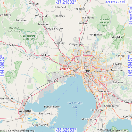
Ardeer GPS coordinates[2]
37° 46' 33.096" South, 144° 48' 5.184" East
| Map corner | latitude | longitude |
|---|---|---|
| Upper-left | -37.21802°, | 144.09832° |
| Center: | -37.77586°, | 144.80144° |
| Lower-right: | -38.32953°, | 145.50457° |
| Map W x H: | 123.6×123.6 km | = 76.8×76.8mi |
| max Lat: | -10.58257° ⇑86.7% North |
| Ardeer: | -37.77586° |
| min Lat: | ⇓13.3% South -43.31423° |
| min Long | Ardeer | max Long |
| 113.53327° | 144.80144° | 153.61246° |
| W 31.1%⇐ | ⇒68.9% E |
Elevation
Elevation of Ardeer is 45 m = 148 ft, and this is 77 m = 253 ft below average elevation for this country.
| Max E: |
1715 m = 5627 ft | 50.4% |
| Avg. | 122 m = 400 ft | |
| Ardeer | 45 m = 148 ft | |
Min E: |
-2 m = -7 ft | 49.6% |
See also: Australia elevation on elevation.city.
Geographical zone
Ardeer is located in South temperate zone (between Tropic of Capricorn and the Antarctic Circle). Distance of this Southern Tropic circle is 1594.4 km =990.7 mi to North.| Distance of | km | miles | from Ardeer |
|---|---|---|---|
| Equator | 4200.3 | 2609.9 | to North |
| Tropic Capricorn | 1594.4 | 990.7 | to North |
| Antarctic Circle | 3200.9 | 1988.9 | to South |
| South Pole | 5806.8 | 3608.2 | to South |


Nearby cities:
15 places around Ardeer: (largest is in red/bold)
• Albanvale
4.4 km =2.7 mi,  318°
318°
• Albion
1.5 km =0.9 mi,  109°
109°
• Braybrook
4.8 km =3 mi,  104°
104°
• Burnside
5.2 km =3.2 mi,  304°
304°
• Cairnlea
2.2 km =1.4 mi,  326°
326°
• Deer Park
3.2 km =2 mi,  287°
287°
• Derrimut
3.3 km =2.1 mi,  236°
236°
• Kealba
4.9 km =3 mi,  28°
28°
• Kings Park
5.1 km =3.2 mi,  335°
335°
• Ravenhall
4.6 km =2.9 mi,  284°
284°
• Saint Albans
4.7 km =2.9 mi,  358°
358°
• St Albans
3.4 km =2.1 mi, 358°
• Sunshine
2.9 km =1.8 mi, 106°
• Sunshine North
2.4 km =1.5 mi,  74°
74°
• Sunshine West
2.1 km =1.3 mi,  142°
142°
Sources, notices
• [Note1] Compared only with cities in Australia existing in our database
• [Src1] Map data: © OpenStreetMap contributors (CC-BY-SA)
• [Src2] Other city data from geonames.org with taken over terms of usage.
• [Src3] Geographical zone / Annual Mean Temperature by Robert A. Rohde @ Wikipedia
