Norman Gardens geodata
Norman Gardens (Queensland) is a section of populated place; located in Australia in Australia/Brisbane (GMT+10) time zone. With population of 9,980 people, there are 601 cities with bigger population in this country. Compared to other cities in Australia, 91.9% of cities are located further ↓South; 58.9% of cities are located further ←West and 56.9% of cities have higher elevation than Norman Gardens. Note1


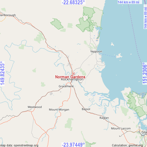
Norman Gardens GPS coordinates[2]
23° 19' 49.584" South, 150° 31' 38.892" East
| Map corner | latitude | longitude |
|---|---|---|
| Upper-left | -22.68325°, | 149.82435° |
| Center: | -23.33044°, | 150.52747° |
| Lower-right: | -23.97449°, | 151.2306° |
| Map W x H: | 143.6×143.6 km | = 89.2×89.2mi |
| max Lat: | -10.58257° ⇑8.1% North |
| Norman Gardens: | -23.33044° |
| min Lat: | ⇓91.9% South -43.31423° |
| min Long | Norman Gardens | max Long |
| 113.53327° | 150.52747° | 153.61246° |
| W 58.9%⇐ | ⇒41.1% E |
Elevation
Elevation of Norman Gardens is 36 m = 118 ft, and this is 86 m = 282 ft below average elevation for this country.
| Max E: |
1715 m = 5627 ft | 56.9% |
| Avg. | 122 m = 400 ft | |
| Norman Gardens | 36 m = 118 ft | |
Min E: |
-2 m = -7 ft | 43.1% |
See also: Australia elevation on elevation.city.
Geographical zone
Norman Gardens is located in South Torrid zone (between Equator and Tropic of Capricorn). Distance of this Southern Tropic circle is 11.8 km =7.3 mi to South.| Distance of | km | miles | from Norman Gardens |
|---|---|---|---|
| Equator | 2594.1 | 1611.9 | to North |
| Tropic Capricorn | 11.8 | 7.3 | to South |
| Antarctic Circle | 4807.1 | 2987 | to South |
| South Pole | 7413 | 4606.2 | to South |


Nearby cities:
15 places around Norman Gardens: (largest is in red/bold)
• Allenstown
7.5 km =4.7 mi,  198°
198°
• Berserker
3.2 km =2 mi,  193°
193°
• Depot Hill
6.7 km =4.2 mi, 185°
• Etna Creek
14.1 km =8.8 mi,  333°
333°
• Frenchville
2.6 km =1.6 mi,  137°
137°
• Gracemere
13.9 km =8.6 mi,  210°
210°
• Kawana
2.5 km =1.6 mi,  246°
246°
• Koongal
4.8 km =3 mi,  152°
152°
• Lakes Creek
6.1 km =3.8 mi,  125°
125°
• Park Avenue
2.7 km =1.7 mi, 199°
• Parkhurst
3.6 km =2.2 mi,  341°
341°
• Rockhampton
6 km =3.7 mi, 201°
• The Range
7.6 km =4.7 mi, 204°
• Wandal
5.5 km =3.4 mi,  218°
218°
• West Rockhampton
7.2 km =4.5 mi, 220°
Sources, notices
• [Note1] Compared only with cities in Australia existing in our database
• [Src1] Map data: © OpenStreetMap contributors (CC-BY-SA)
• [Src2] Other city data from geonames.org with taken over terms of usage.
• [Src3] Geographical zone / Annual Mean Temperature by Robert A. Rohde @ Wikipedia
