Koongal geodata
Koongal (Queensland) is a section of populated place; located in Australia in Australia/Brisbane (GMT+10) time zone. With population of 4,164 people, there are 1735 cities with bigger population in this country. Compared to other cities in Australia, 91.7% of cities are located further ↓South; 59.1% of cities are located further ←West and 76.1% of cities have higher elevation than Koongal. Note1


Koongal GPS coordinates[2]
23° 22' 7.932" South, 150° 32' 57.012" East
| Map corner | latitude | longitude |
|---|---|---|
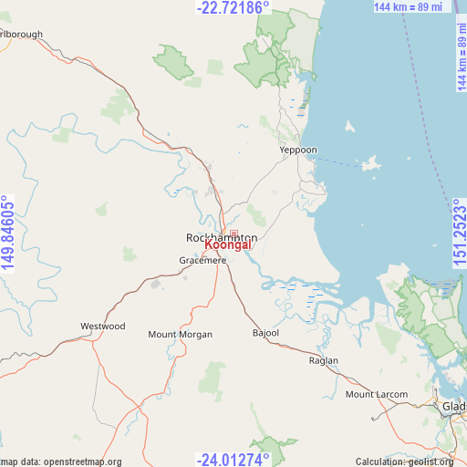
| Upper-left | -22.72186°, | 149.84605° |
| Center: | -23.36887°, | 150.54917° |
| Lower-right: | -24.01274°, | 151.2523° |
| Map W x H: | 143.5×143.5 km | = 89.2×89.2mi |
| max Lat: | -10.58257° ⇑8.3% North |
| Koongal: | -23.36887° |
| min Lat: | ⇓91.7% South -43.31423° |
| min Long | Koongal | max Long |
| 113.53327° | 150.54917° | 153.61246° |
| W 59.1%⇐ | ⇒40.9% E |
Elevation
Elevation of Koongal is 18 m = 59 ft, and this is 104 m = 341 ft below average elevation for this country.
| Max E: |
1715 m = 5627 ft | 76.1% |
| Avg. | 122 m = 400 ft | |
| Koongal | 18 m = 59 ft | |
Min E: |
-2 m = -7 ft | 23.9% |
See also: Australia elevation on elevation.city.
Geographical zone
Koongal is located in South Torrid zone (between Equator and Tropic of Capricorn). Distance of this Southern Tropic circle is 7.5 km =4.7 mi to South.| Distance of | km | miles | from Koongal |
|---|---|---|---|
| Equator | 2598.4 | 1614.6 | to North |
| Tropic Capricorn | 7.5 | 4.7 | to South |
| Antarctic Circle | 4802.8 | 2984.3 | to South |
| South Pole | 7408.7 | 4603.6 | to South |


Nearby cities:
15 places around Koongal: (largest is in red/bold)
• Allenstown
5.4 km =3.4 mi,  238°
238°
• Berserker
3.2 km =2 mi,  292°
292°
• Cawarral
16.5 km =10.3 mi,  46°
46°
• Depot Hill
3.7 km =2.3 mi,  230°
230°
• Frenchville
2.4 km =1.5 mi,  348°
348°
• Gracemere
12.1 km =7.5 mi, 230°
• Kawana
5.6 km =3.5 mi,  306°
306°
• Lakes Creek
2.9 km =1.8 mi,  74°
74°
• Norman Gardens
4.8 km =3 mi,  332°
332°
• Park Avenue
3.5 km =2.2 mi,  299°
299°
• Parkhurst
8.3 km =5.2 mi,  336°
336°
• Rockhampton
4.6 km =2.9 mi,  253°
253°
• The Range
6 km =3.7 mi, 244°
• Wandal
5.7 km =3.5 mi,  270°
270°
• West Rockhampton
7 km =4.3 mi,  260°
260°
Sources, notices
• [Note1] Compared only with cities in Australia existing in our database
• [Src1] Map data: © OpenStreetMap contributors (CC-BY-SA)
• [Src2] Other city data from geonames.org with taken over terms of usage.
• [Src3] Geographical zone / Annual Mean Temperature by Robert A. Rohde @ Wikipedia
