Bundall geodata
Bundall (Queensland) is a section of populated place; located in Australia in Australia/Brisbane (GMT+10) time zone. With population of 4,424 people, there are 1644 cities with bigger population in this country. Compared to other cities in Australia, 76% of cities are located further ↓South; 98.8% of cities are located further ←West and 98.8% of cities have higher elevation than Bundall. Note1


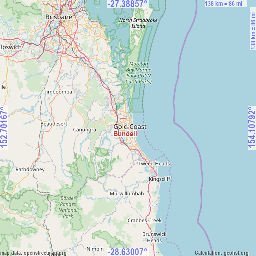
Bundall GPS coordinates[2]
28° 0' 39.996" South, 153° 24' 17.244" East
| Map corner | latitude | longitude |
|---|---|---|
| Upper-left | -27.38857°, | 152.70167° |
| Center: | -28.01111°, | 153.40479° |
| Lower-right: | -28.63007°, | 154.10792° |
| Map W x H: | 138×138 km | = 85.7×85.7mi |
| max Lat: | -10.58257° ⇑24% North |
| Bundall: | -28.01111° |
| min Lat: | ⇓76% South -43.31423° |
| min Long | Bundall | max Long |
| 113.53327° | 153.40479° | 153.61246° |
| W 98.8%⇐ | ⇒1.2% E |
Elevation
Elevation of Bundall is 3 m = 10 ft, and this is 119 m = 390 ft below average elevation for this country.
| Max E: |
1715 m = 5627 ft | 98.8% |
| Avg. | 122 m = 400 ft | |
| Bundall | 3 m = 10 ft | |
Min E: |
-2 m = -7 ft | 1.2% |
See also: Australia elevation on elevation.city.
Geographical zone
Bundall is located in South temperate zone (between Tropic of Capricorn and the Antarctic Circle). Distance of this Southern Tropic circle is 508.6 km =316 mi to North.| Distance of | km | miles | from Bundall |
|---|---|---|---|
| Equator | 3114.5 | 1935.3 | to North |
| Tropic Capricorn | 508.6 | 316 | to North |
| Antarctic Circle | 4286.6 | 2663.6 | to South |
| South Pole | 6892.5 | 4282.8 | to South |


Nearby cities:
15 places around Bundall: (largest is in red/bold)
• Ashmore
3.7 km =2.3 mi,  311°
311°
• Benowa
1.9 km =1.2 mi,  281°
281°
• Broadbeach
3.4 km =2.1 mi,  123°
123°
• Broadbeach Waters
3.3 km =2.1 mi,  143°
143°
• Carrara
3.9 km =2.4 mi,  252°
252°
• Clear Island Waters
4.7 km =2.9 mi,  187°
187°
• Gold Coast
2.8 km =1.7 mi,  64°
64°
• Main Beach
4.2 km =2.6 mi,  30°
30°
• Mermaid Beach
4.7 km =2.9 mi, 141°
• Mermaid Waters
4.9 km =3 mi,  148°
148°
• Merrimac
5.4 km =3.4 mi,  215°
215°
• Molendinar
6 km =3.7 mi, 313°
• Robina
6.7 km =4.2 mi, 189°
• Southport
4.9 km =3 mi,  352°
352°
• Surfers Paradise
2.6 km =1.6 mi,  69°
69°
Sources, notices
• [Note1] Compared only with cities in Australia existing in our database
• [Src1] Map data: © OpenStreetMap contributors (CC-BY-SA)
• [Src2] Other city data from geonames.org with taken over terms of usage.
• [Src3] Geographical zone / Annual Mean Temperature by Robert A. Rohde @ Wikipedia
