Reid geodata
Reid (ACT) is a section of populated place; located in Australia in Australia/Sydney (GMT+11) time zone. With population of 1,590 people, there are 3198 cities with bigger population in this country. Compared to other cities in Australia, 75.4% of cities are located further ↑North; 54.7% of cities are located further ←West and 94.6% of cities have lower elevation than Reid. Note1


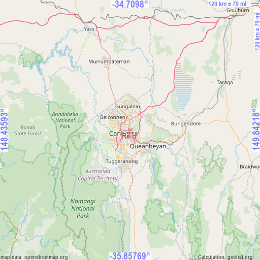
Reid GPS coordinates[2]
35° 17' 8.808" South, 149° 8' 20.58" East
| Map corner | latitude | longitude |
|---|---|---|
| Upper-left | -34.7098°, | 148.43593° |
| Center: | -35.28578°, | 149.13905° |
| Lower-right: | -35.85769°, | 149.84218° |
| Map W x H: | 127.6×127.6 km | = 79.3×79.3mi |
| max Lat: | -10.58257° ⇑75.4% North |
| Reid: | -35.28578° |
| min Lat: | ⇓24.6% South -43.31423° |
| min Long | Reid | max Long |
| 113.53327° | 149.13905° | 153.61246° |
| W 54.7%⇐ | ⇒45.3% E |
Elevation
Elevation of Reid is 572 m = 1877 ft, and this is 450 m = 1476 ft above average elevation for this country.
| Max E: |
1715 m = 5627 ft | 5.4% |
| Reid | 572 m 1877 ft | |
| Avg. | 122 m = 400 ft | |
Min E: |
-2 m = -7 ft | 94.6% |
See also: Australia elevation on elevation.city.
Geographical zone
Reid is located in South temperate zone (between Tropic of Capricorn and the Antarctic Circle). Distance of this Southern Tropic circle is 1317.5 km =818.7 mi to North.| Distance of | km | miles | from Reid |
|---|---|---|---|
| Equator | 3923.4 | 2437.9 | to North |
| Tropic Capricorn | 1317.5 | 818.7 | to North |
| Antarctic Circle | 3477.8 | 2161 | to South |
| South Pole | 6083.7 | 3780.2 | to South |


Nearby cities:
15 places around Reid: (largest is in red/bold)
• Acton
2.1 km =1.3 mi,  295°
295°
• Ainslie
2.6 km =1.6 mi,  9°
9°
• Barton
2.1 km =1.3 mi,  174°
174°
• Braddon
1.7 km =1.1 mi,  349°
349°
• Campbell
1.4 km =0.9 mi,  105°
105°
• Canberra
1 km =0.6 mi,  284°
284°
• City
1 km =0.6 mi, 299°
• Dickson
3.9 km =2.4 mi,  0°
0°
• Downer
4.6 km =2.9 mi, 6°
• Forrest
3.4 km =2.1 mi,  196°
196°
• Griffith
4.4 km =2.7 mi,  182°
182°
• Kingston
3.3 km =2.1 mi, 168°
• O'Connor
4.1 km =2.5 mi,  323°
323°
• Turner
2.3 km =1.4 mi,  325°
325°
• Yarralumla
3.4 km =2.1 mi,  242°
242°
Sources, notices
• [Note1] Compared only with cities in Australia existing in our database
• [Src1] Map data: © OpenStreetMap contributors (CC-BY-SA)
• [Src2] Other city data from geonames.org with taken over terms of usage.
• [Src3] Geographical zone / Annual Mean Temperature by Robert A. Rohde @ Wikipedia
