Forrest geodata
Forrest (ACT) is a section of populated place; located in Australia in Australia/Sydney (GMT+11) time zone. With population of 1,907 people, there are 2966 cities with bigger population in this country. Compared to other cities in Australia, 75.5% of cities are located further ↑North; 54.5% of cities are located further ←West and 95.1% of cities have lower elevation than Forrest. Note1


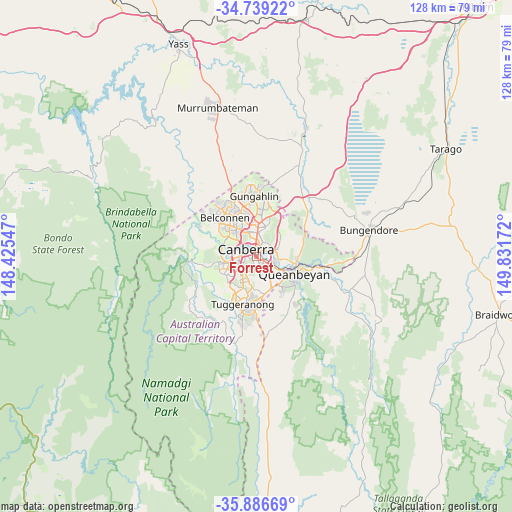
Forrest GPS coordinates[2]
35° 18' 53.964" South, 149° 7' 42.924" East
| Map corner | latitude | longitude |
|---|---|---|
| Upper-left | -34.73922°, | 148.42547° |
| Center: | -35.31499°, | 149.12859° |
| Lower-right: | -35.88669°, | 149.83172° |
| Map W x H: | 127.6×127.6 km | = 79.3×79.3mi |
| max Lat: | -10.58257° ⇑75.5% North |
| Forrest: | -35.31499° |
| min Lat: | ⇓24.5% South -43.31423° |
| min Long | Forrest | max Long |
| 113.53327° | 149.12859° | 153.61246° |
| W 54.5%⇐ | ⇒45.5% E |
Elevation
Elevation of Forrest is 583 m = 1913 ft, and this is 461 m = 1512 ft above average elevation for this country.
| Max E: |
1715 m = 5627 ft | 4.9% |
| Forrest | 583 m 1913 ft | |
| Avg. | 122 m = 400 ft | |
Min E: |
-2 m = -7 ft | 95.1% |
See also: Australia elevation on elevation.city.
Geographical zone
Forrest is located in South temperate zone (between Tropic of Capricorn and the Antarctic Circle). Distance of this Southern Tropic circle is 1320.7 km =820.6 mi to North.| Distance of | km | miles | from Forrest |
|---|---|---|---|
| Equator | 3926.7 | 2439.9 | to North |
| Tropic Capricorn | 1320.7 | 820.6 | to North |
| Antarctic Circle | 3474.5 | 2159 | to South |
| South Pole | 6080.4 | 3778.2 | to South |


Nearby cities:
15 places around Forrest: (largest is in red/bold)
• Acton
4.3 km =2.7 mi,  347°
347°
• Barton
1.6 km =1 mi,  45°
45°
• Campbell
3.7 km =2.3 mi,  38°
38°
• Canberra
3.5 km =2.2 mi,  359°
359°
• City
3.8 km =2.4 mi,  0°
0°
• Deakin
2.4 km =1.5 mi,  258°
258°
• Garran
3.5 km =2.2 mi,  211°
211°
• Griffith
1.4 km =0.9 mi,  145°
145°
• Hughes
3.6 km =2.2 mi,  237°
237°
• Kingston
1.6 km =1 mi,  91°
91°
• Narrabundah
3 km =1.9 mi,  140°
140°
• O'Malley
4.4 km =2.7 mi,  198°
198°
• Red Hill
1.5 km =0.9 mi, 214°
• Reid
3.4 km =2.1 mi,  16°
16°
• Yarralumla
2.7 km =1.7 mi,  309°
309°
Sources, notices
• [Note1] Compared only with cities in Australia existing in our database
• [Src1] Map data: © OpenStreetMap contributors (CC-BY-SA)
• [Src2] Other city data from geonames.org with taken over terms of usage.
• [Src3] Geographical zone / Annual Mean Temperature by Robert A. Rohde @ Wikipedia
